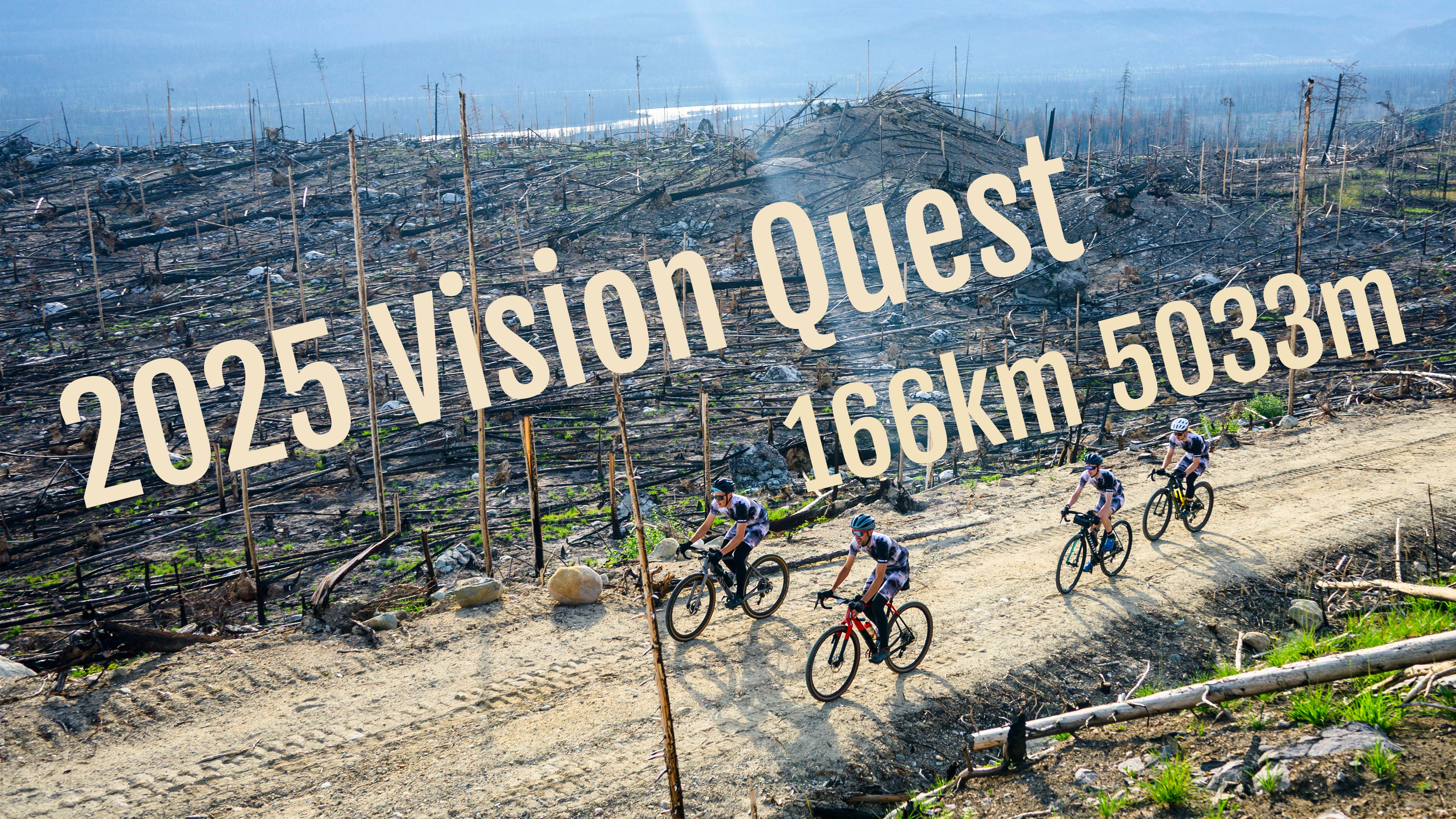
2025 Vision Quest
166km, 5000m and 12 hours of Jasper, Alberta's finest gravel.

For the past couple of years, I’ve cooked up a ride that would be sure to induce suffering. The rules are simple: the ride needs to be bigger than the previous year, it has to be harder, and there has to be a chance that it can’t be done. If completing the route is a given, then it’s not a true Vision Quest. Last year’s ride was 210 km with 4000 m of elevation. You can read about it here. Having ridden all of the big terrain in Jasper, I was starting to wonder how I would make it harder while still keeping it in Jasper. Luckily for me, I had been chatting with Declan Unsworth, a Jasper local and fellow masochist, who had scoped out a nasty climb the year before.
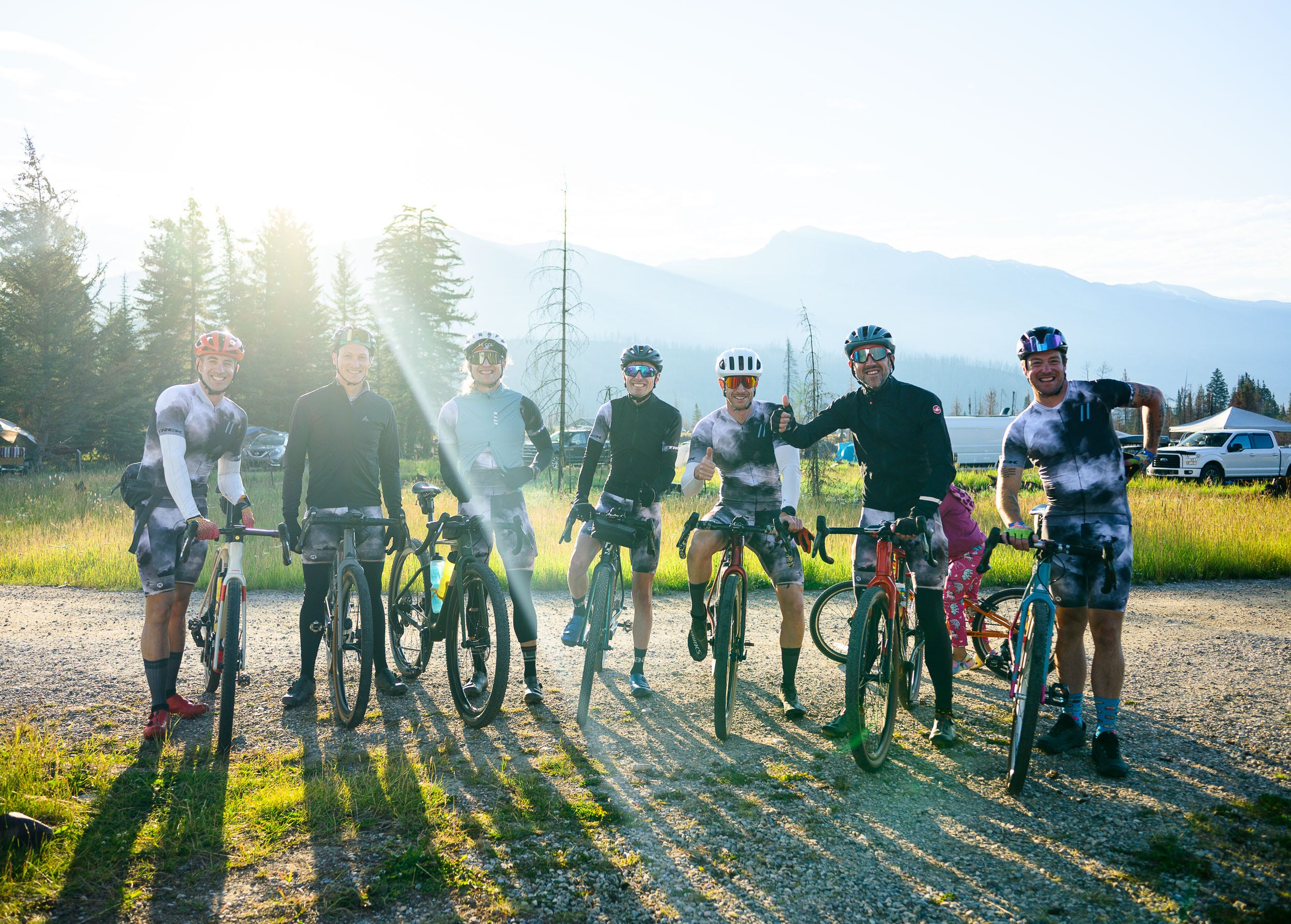
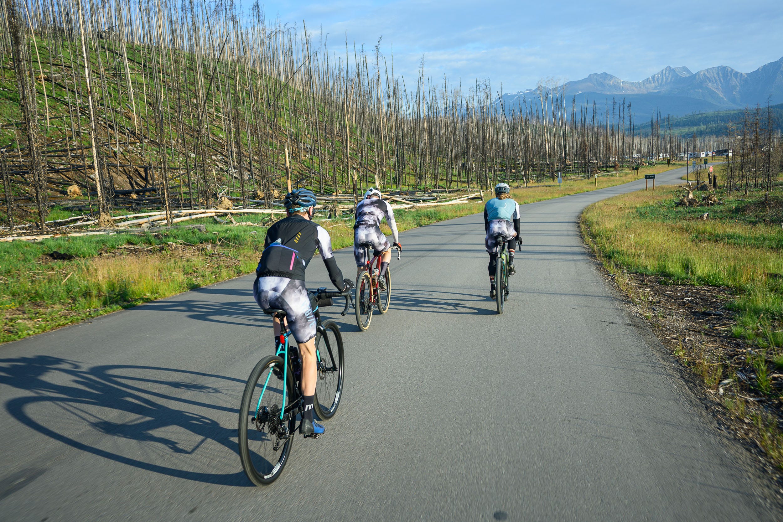
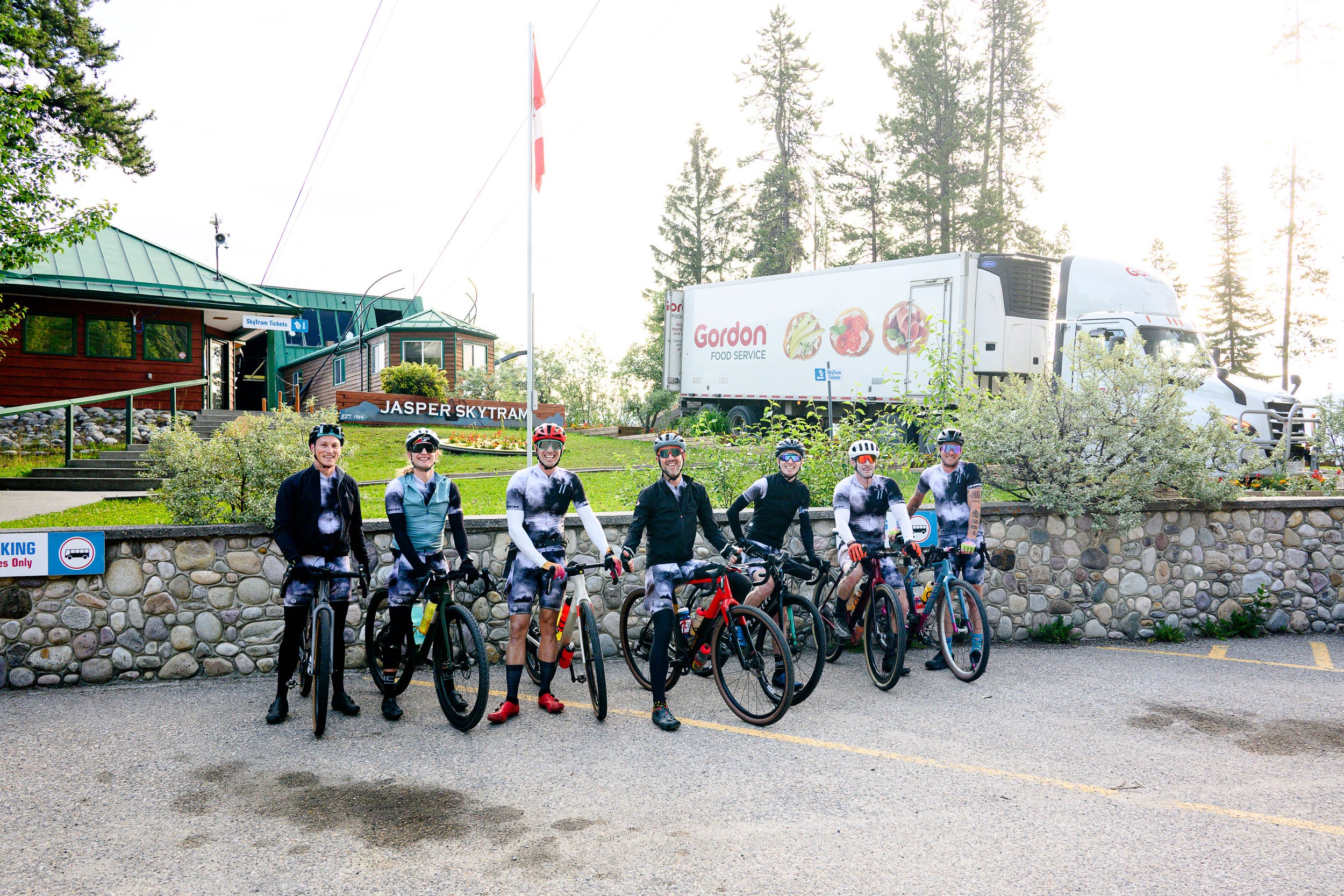
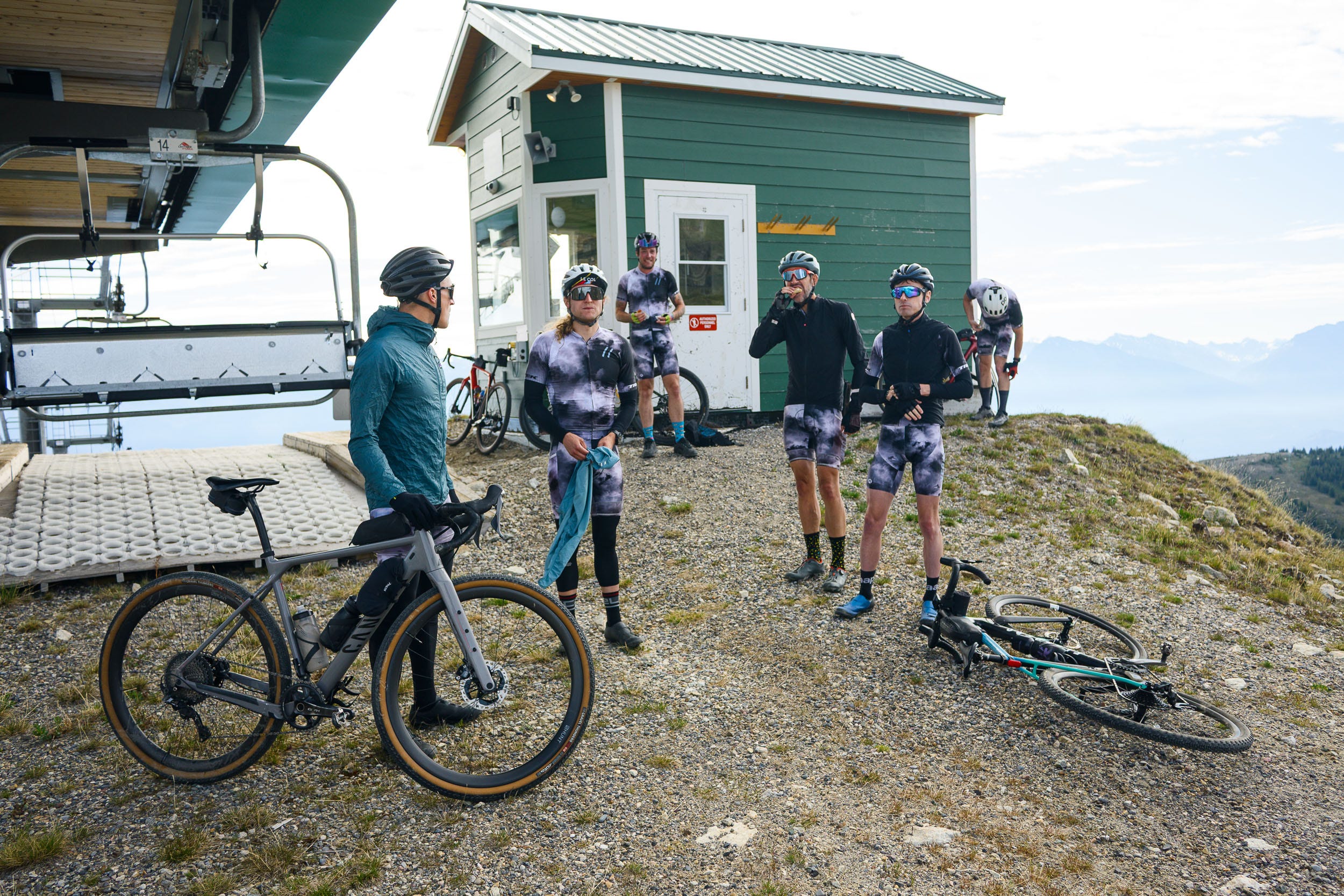
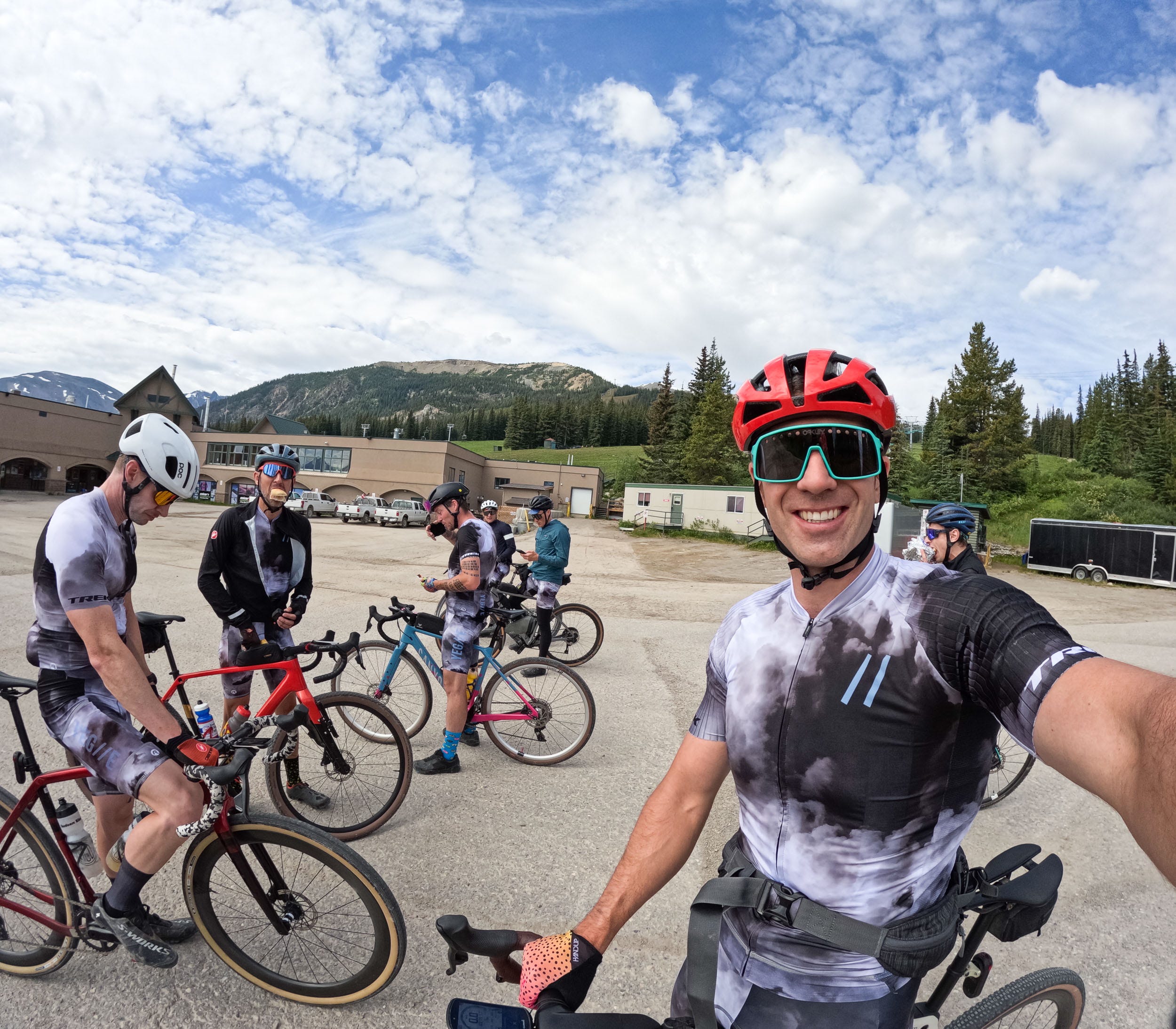
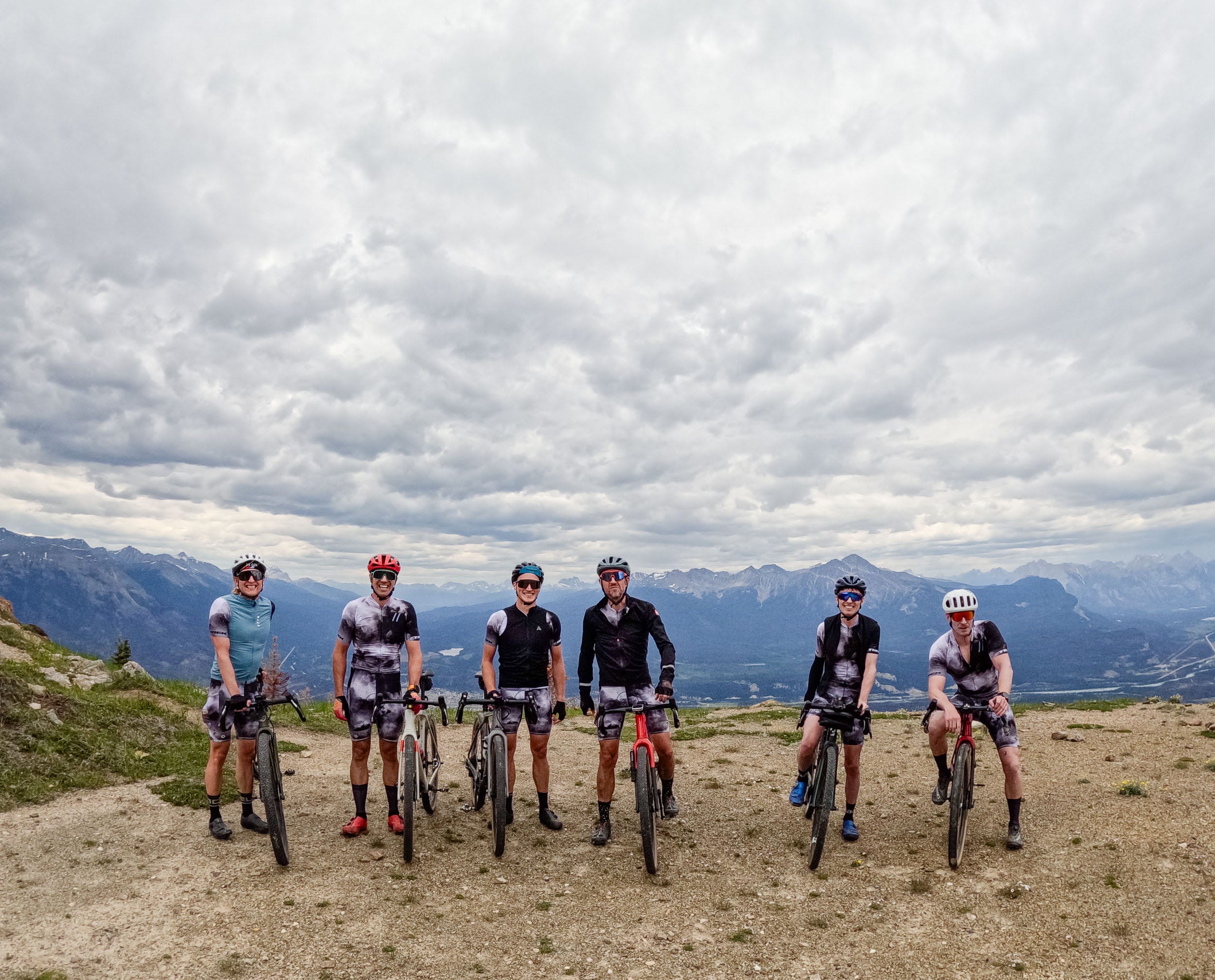
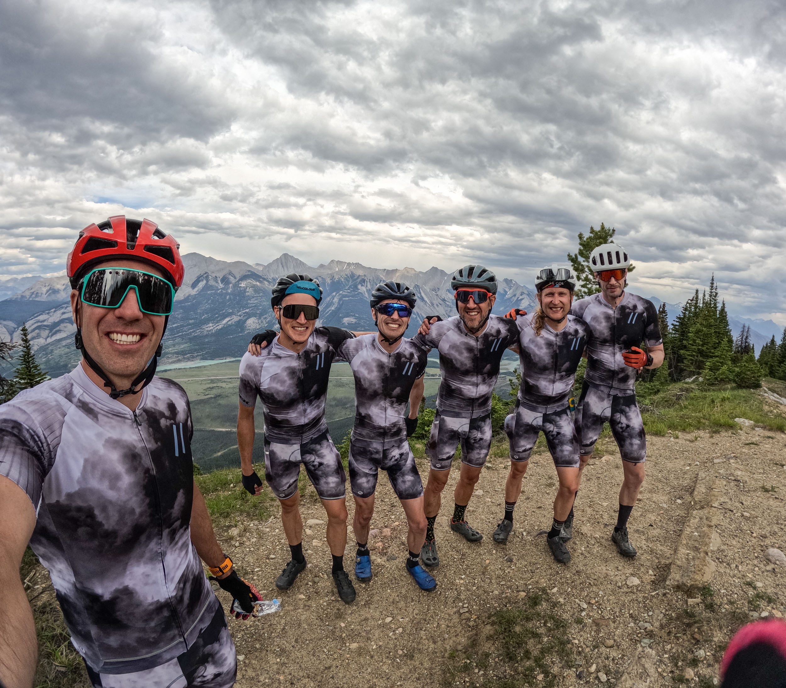
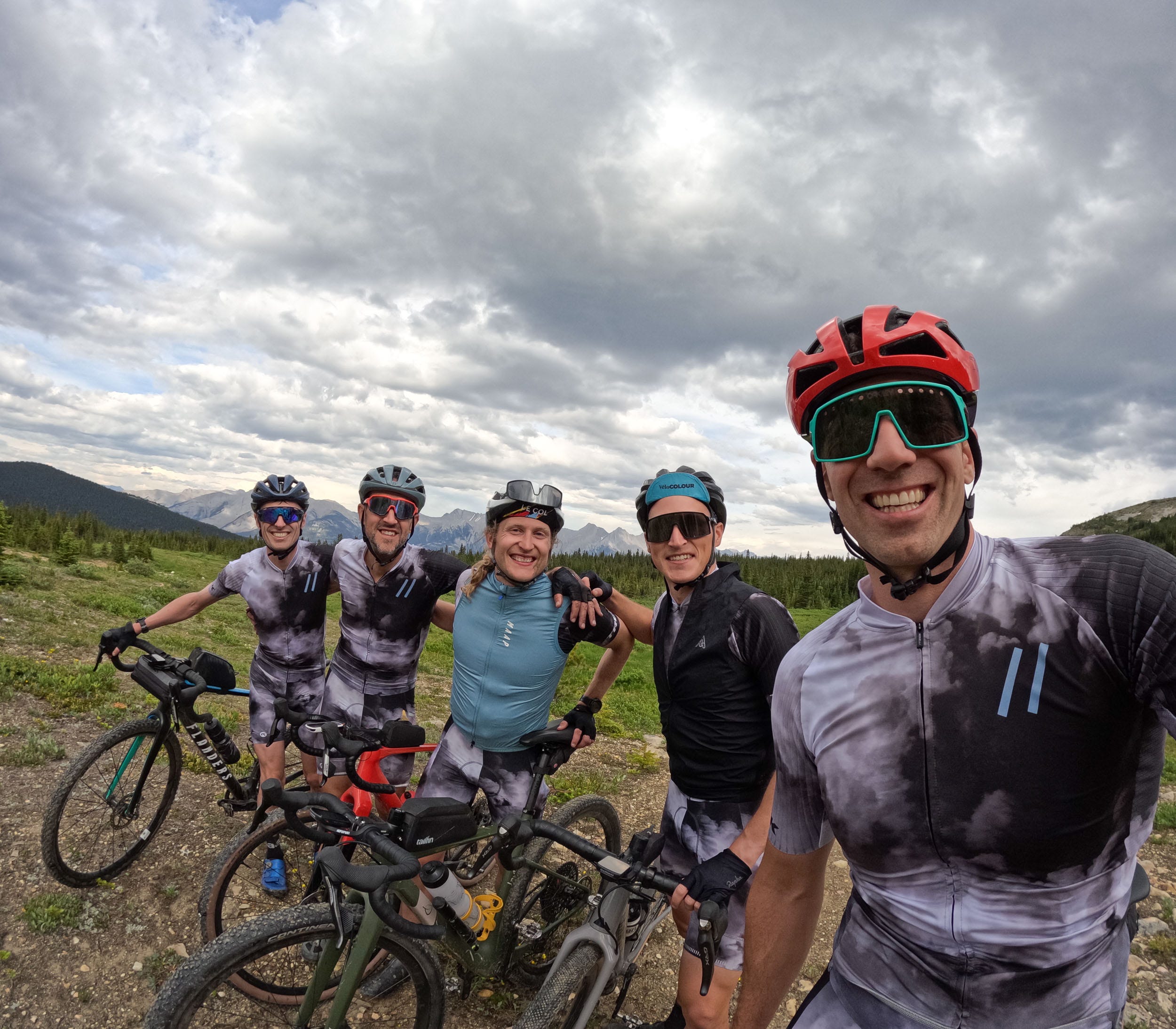
For some reason, my friends keep joining me on these rides despite them likely taking years off their lives. This year, I had six other guys along for the ride. Like last year, we camped at Whistlers Campground, which, after having been destroyed by the fires that occurred the week after our ride last summer, is basically just a parking lot where you can park your camper or tent. Parks Canada have done their best to make it feel like a campground, but there’s only so much you can do when there isn’t a single tree left standing. Most of us rolled into Jasper early Friday afternoon so that we could get settled and enjoy some family time before the ride the following day.
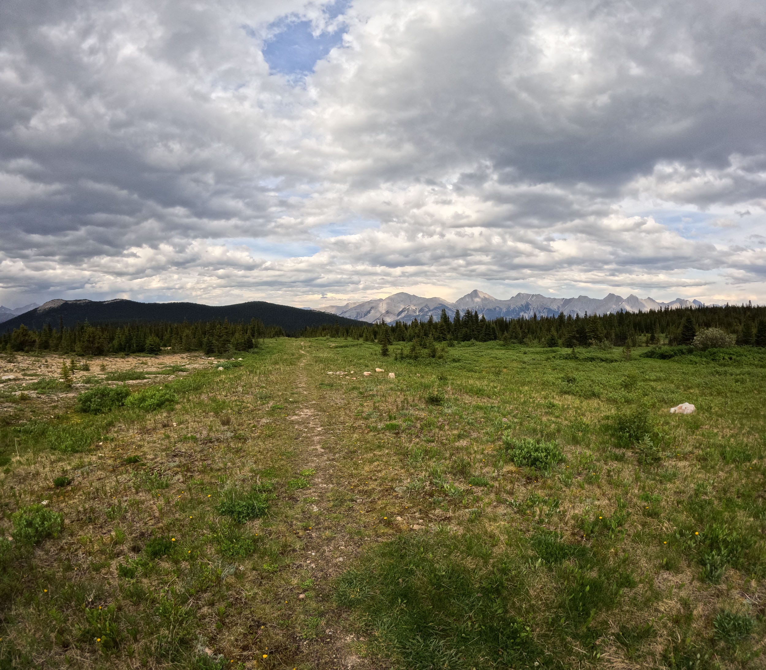
The ride plan for this year was to warm up on the Tram Climb that starts at the entrance to the campground, then hit up the Marmot climb to the top of the Paradise chairlift via an old gravel access road, then the Edith Cavell climb, come back through camp to refuel, ride up Signal Mountain, and then back across the valley for the Palisades and Pyramid climbs. This would tip us over 5000 m of total elevation. This year, we wouldn’t be hitting the same distance as the climbing is much more condensed, a different kind of punishment without the fluff miles between the climbs.
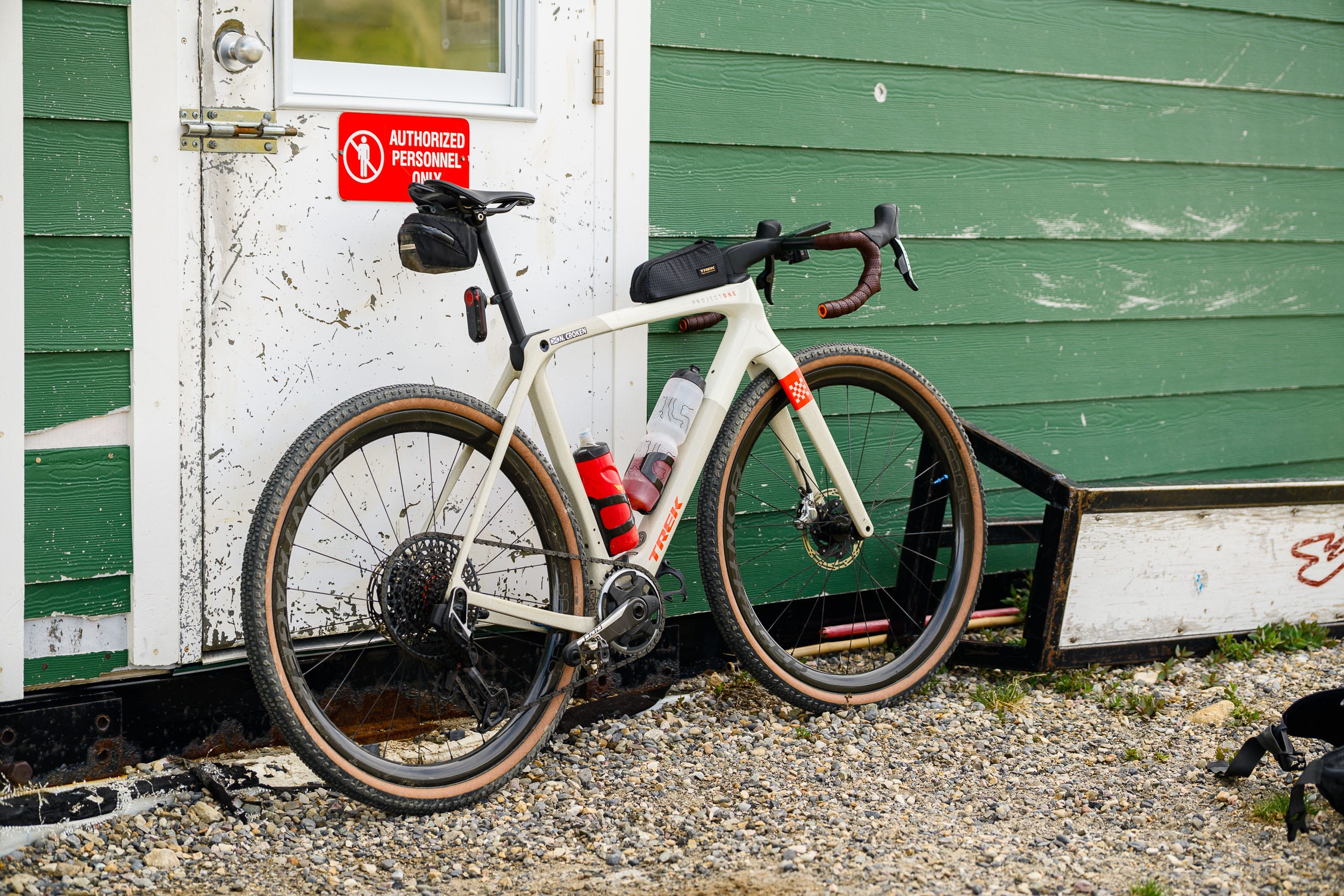
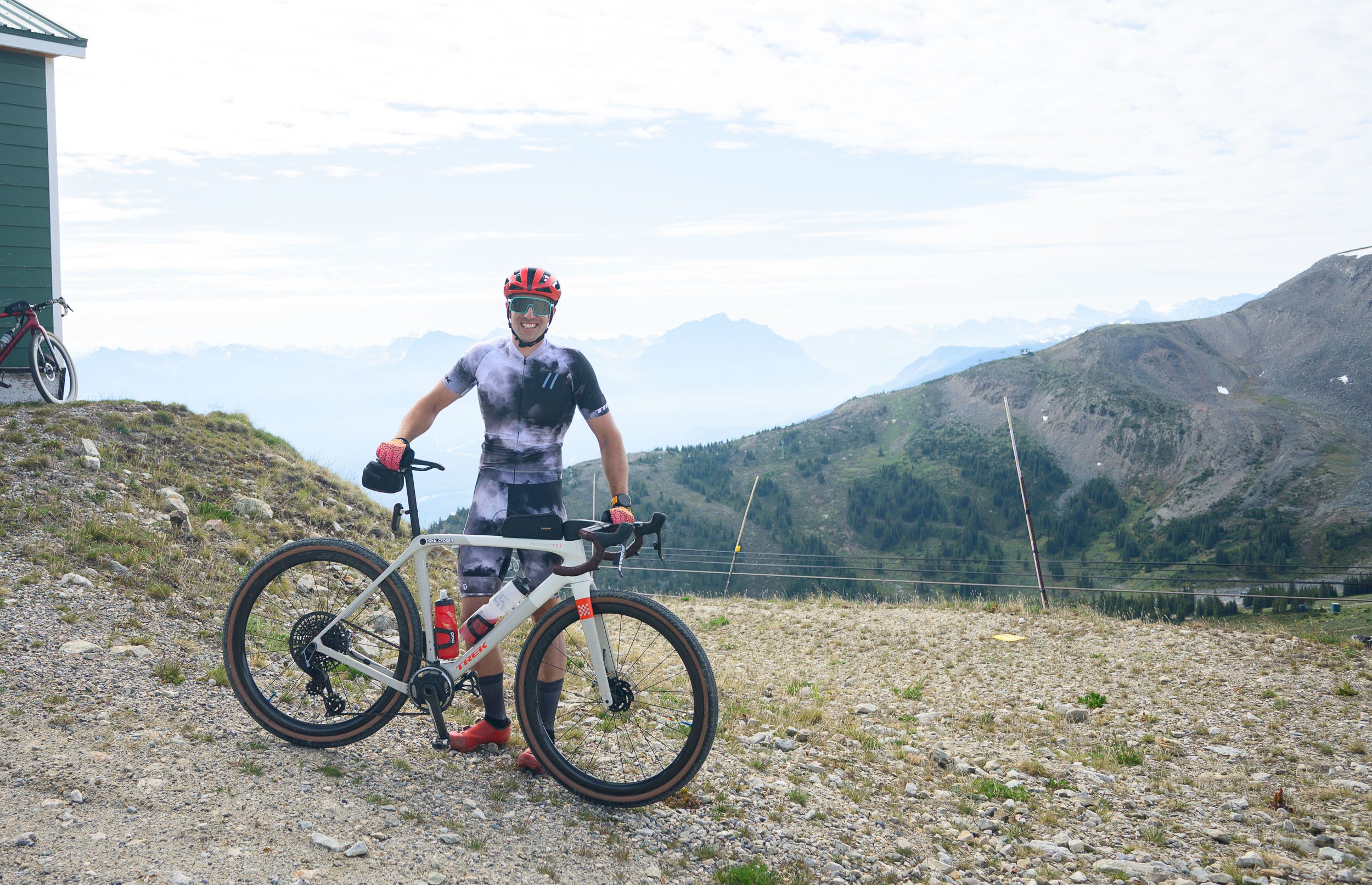
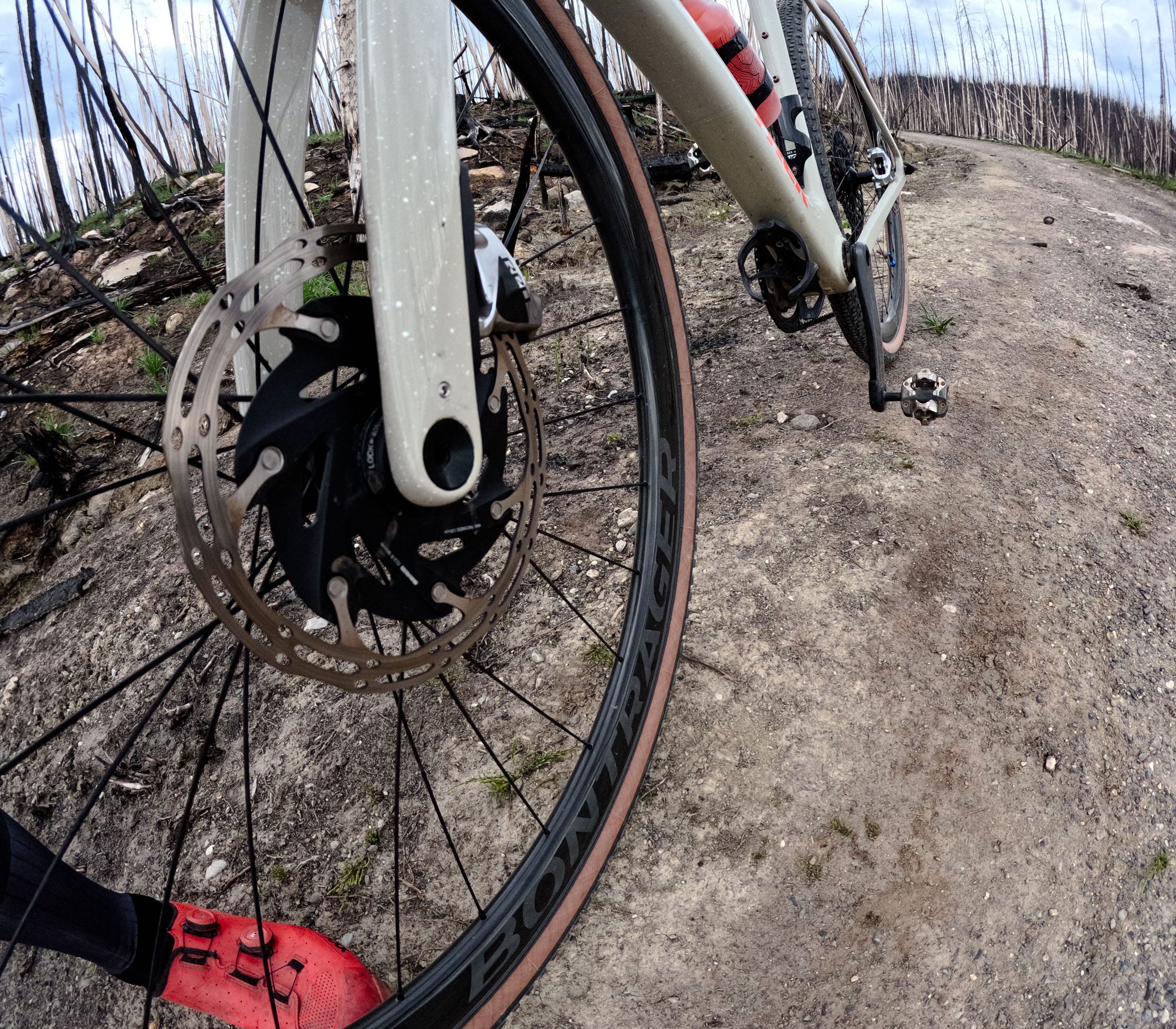
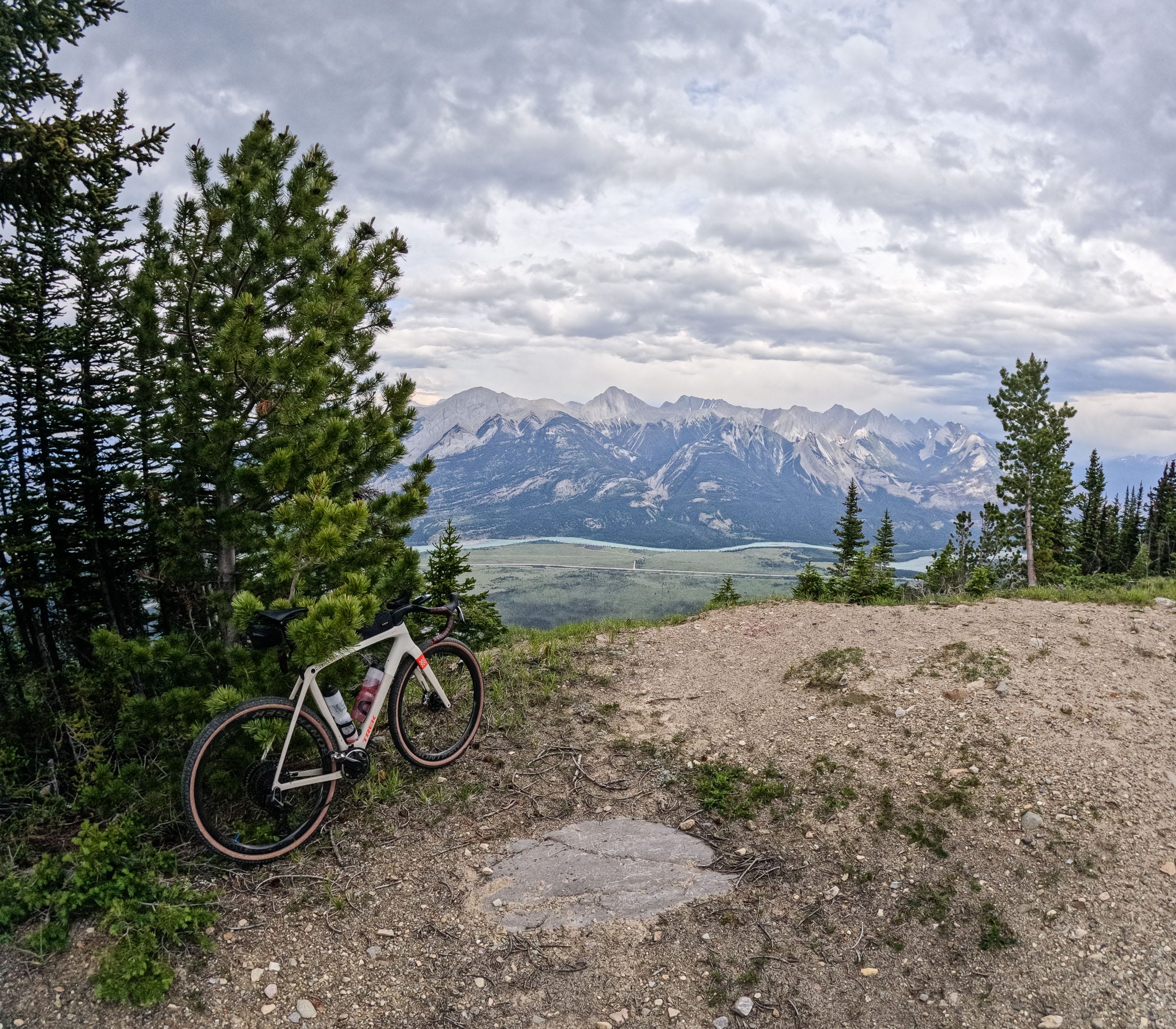
With the expectation of steeper climbs and rougher terrain, I made a few changes to my bike setup for this ride. Last year, I did the ride on a Trek Checkpoint SLR. This year, I was on the Trek Checkmate SLR. Most of the gravel riding I do is fast-paced and largely on terrain that isn’t technical, so the bike is built up for speed over everything else. The first big change that I made was dropping my front chainring down to a 40t from my 46. I was still not convinced that a 40 up front and a 44 out back would be low enough gearing to be able to ride the steepest sections of the route. I also changed the drivetrain completely. I pulled the XO Transmission derailleur and cassette off my mountain bike and mounted it to the Checkmate. Having a UDH-compatible gravel bike is massive, as many folks would prefer this gearing setup for all of their rides. Being able to mix and match road and mountain bike components is one of the largest reasons that every bike in our household is SRAM-equipped. The other change I made was a move from my 45 mm semi-slick Panaracer tires to the 50 mm knobby Betasso tires made by Bontrager. On top of that, I also mounted my CushCore tire inserts. I was less worried about tire size on the ascents but feared the massive rocks and steep grades would be too much for the semi-slicks to be ridden at speed. Not getting a puncture or sidewall slash was very important for this ride, as 80 percent of the route is inaccessible by car and I’d have a long walk out if I destroyed a tire.
07:20 0km 0m gained
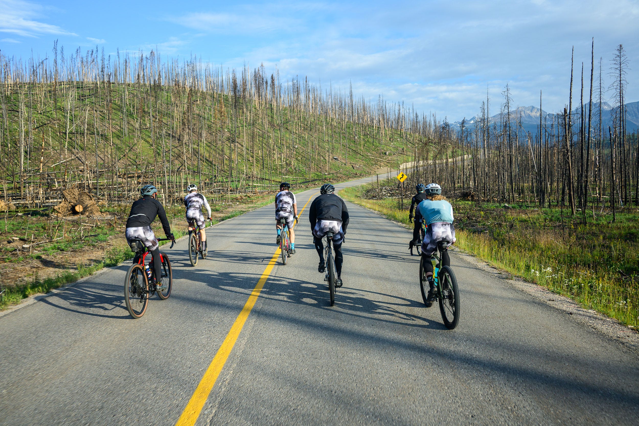
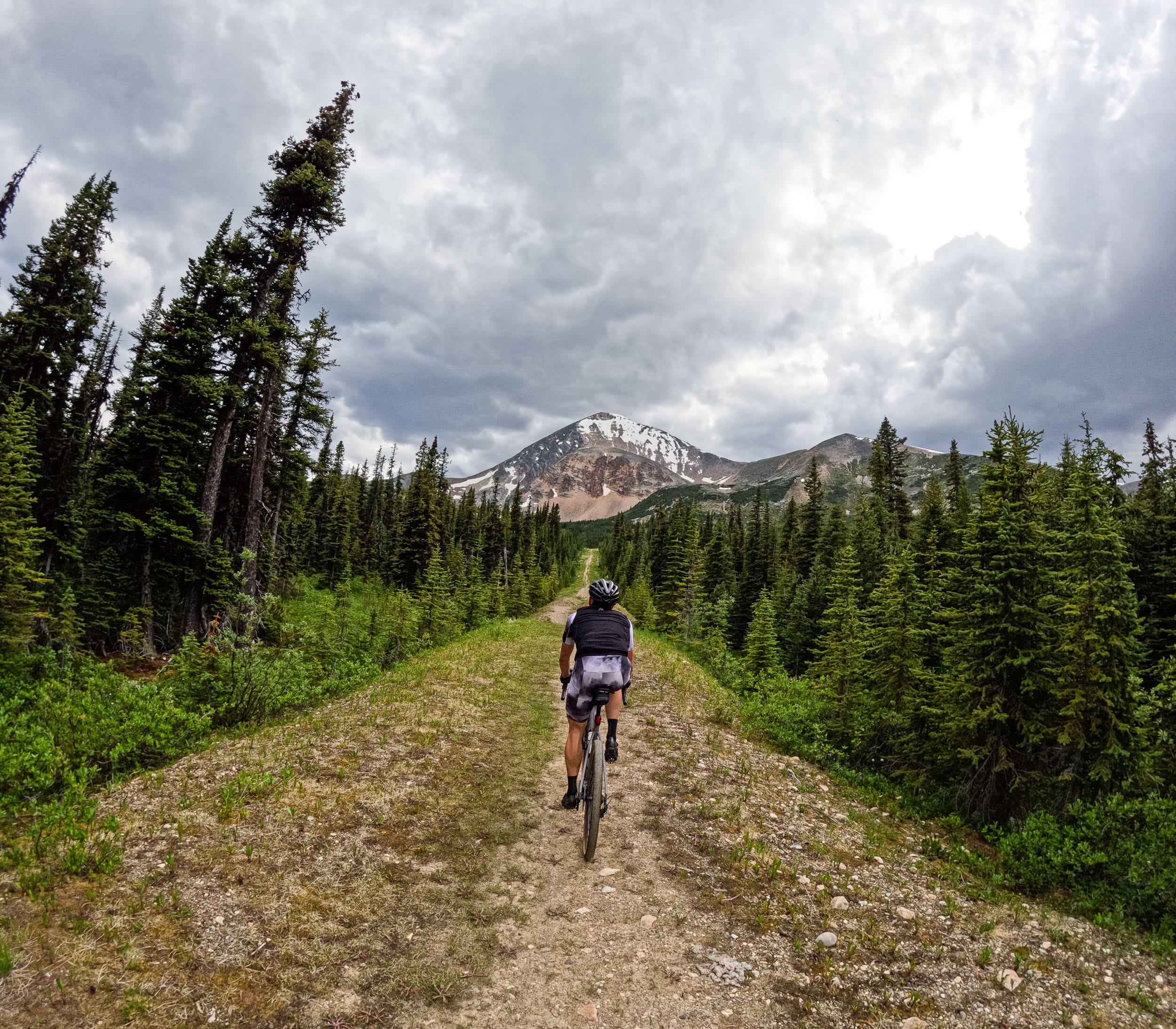
We rolled out of camp just before 7:30 a.m. with the mantra of “be bold, start cold,” as the air was a bit crisp. As expected, we immediately warmed up as soon as the road pitched up toward the Whistler Sky Tram. This is one of the two paved climbs on the route and the perfect warmup. While the climb starts out mellow, it quickly ramps to a sustained 14 percent which, with gravel gearing, isn’t so bad. As we made our way up the climb, we had our first real views of the damage that the fires had caused. Despite having been burnt a year earlier, the smell of fire was still lingering in the air. At the top of the climb, we were lucky enough to have someone offer to take a group photo of us, a lucky surprise as the tram was not open yet. Not wanting to waste any time, we quickly turned around and headed to our next objective. As it was still before 8, the 70 km/h descent was very, very brisk. Thankfully, it was short-lived.
07:45 8.4km 265m gained
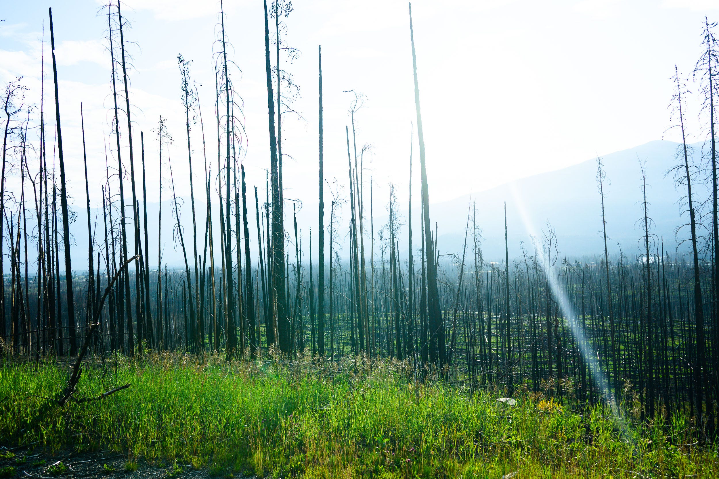
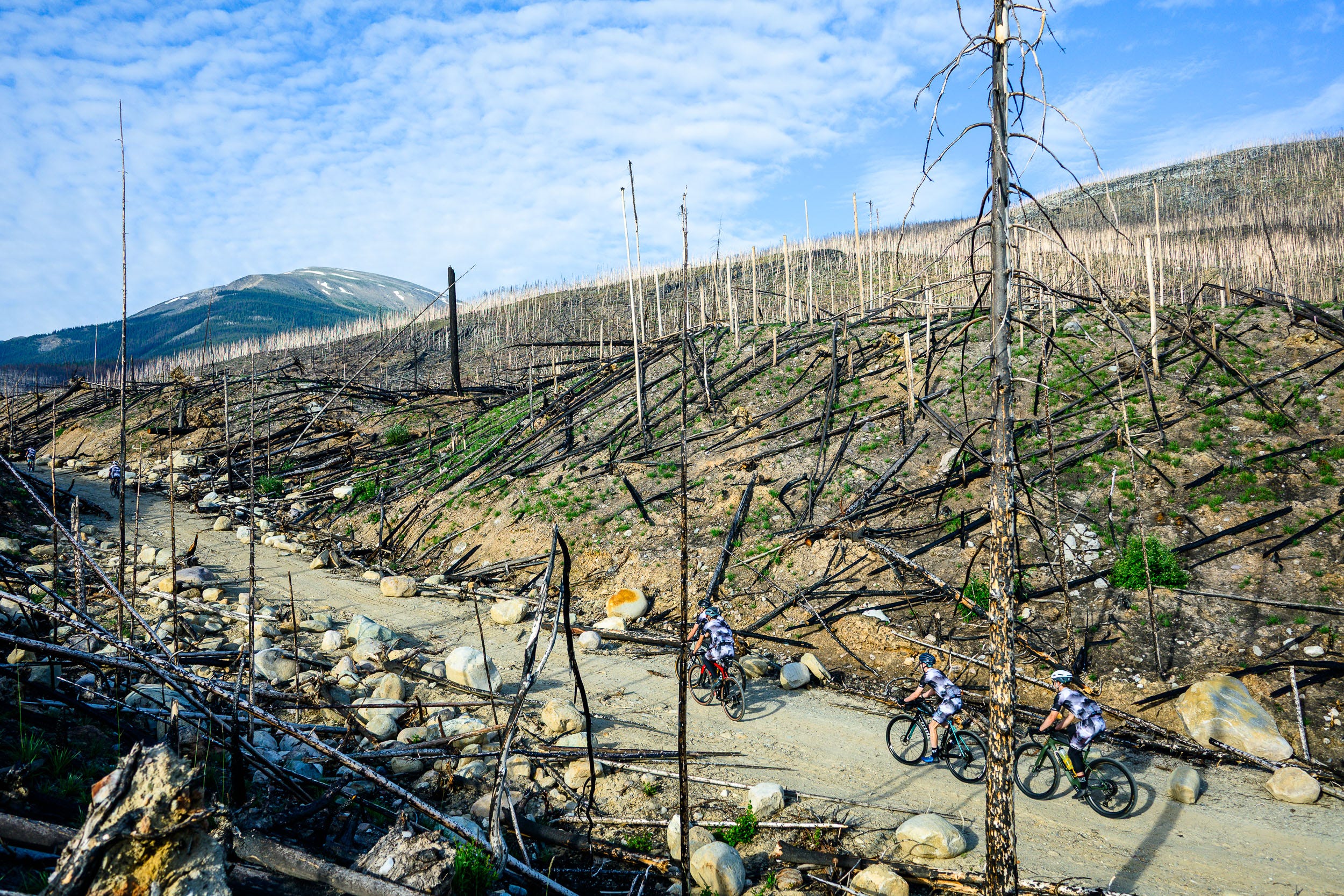
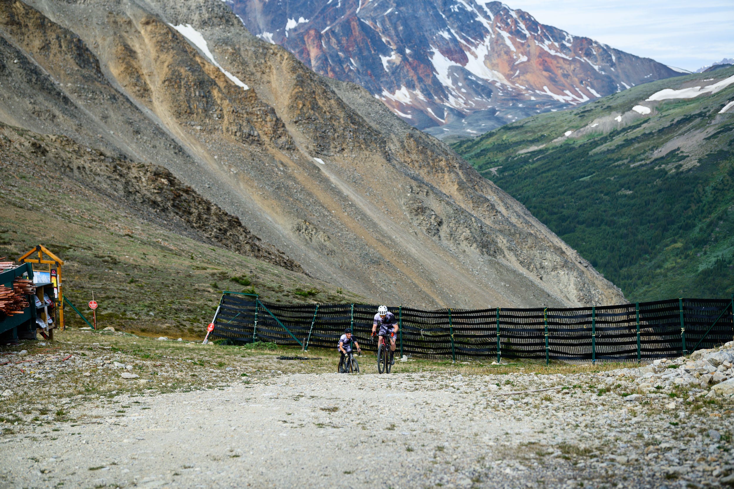
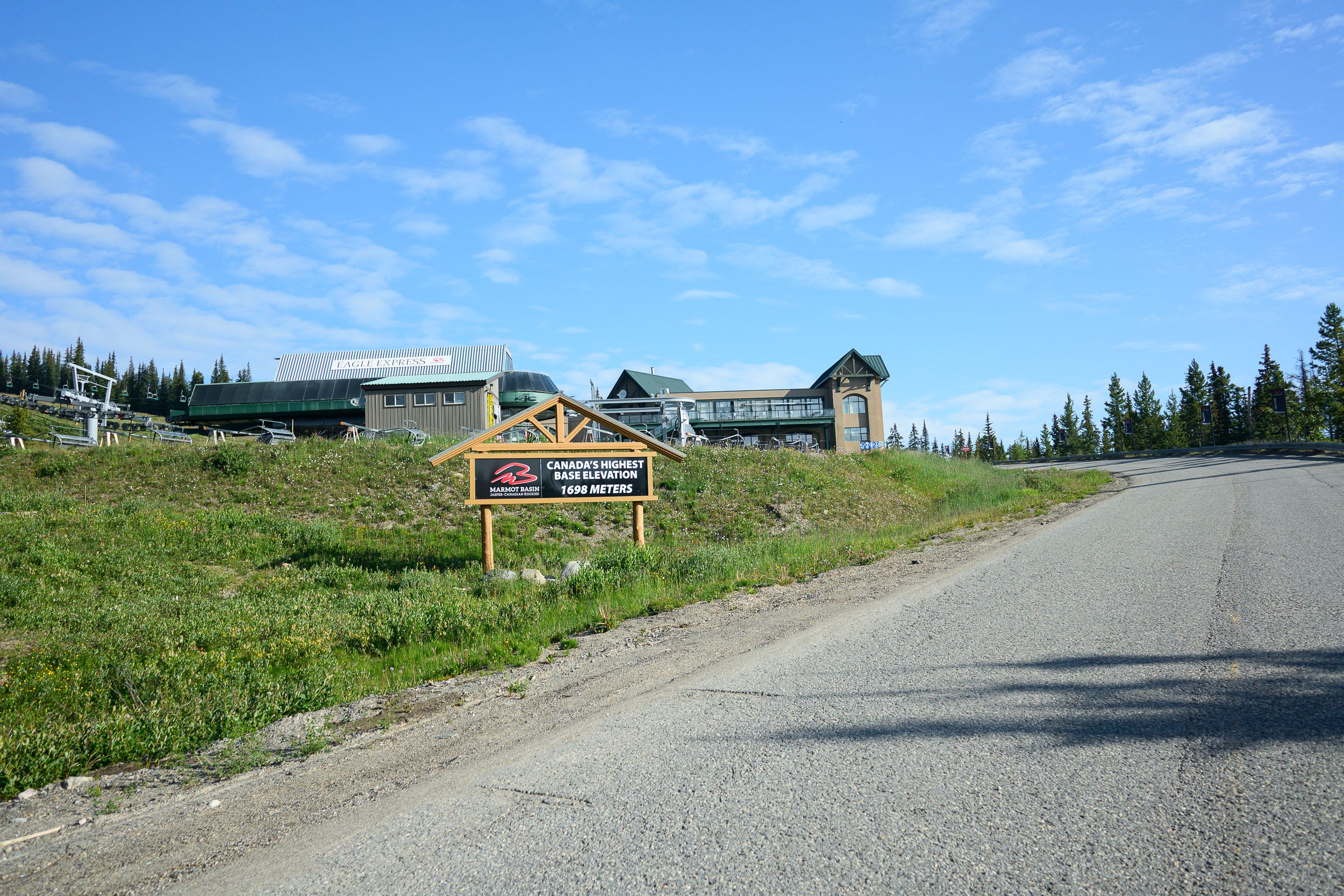
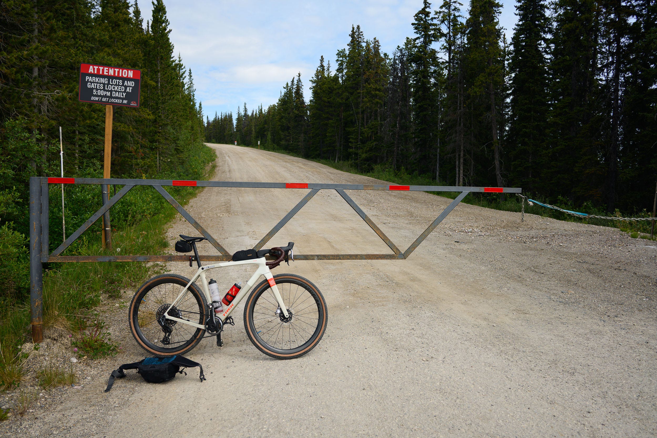
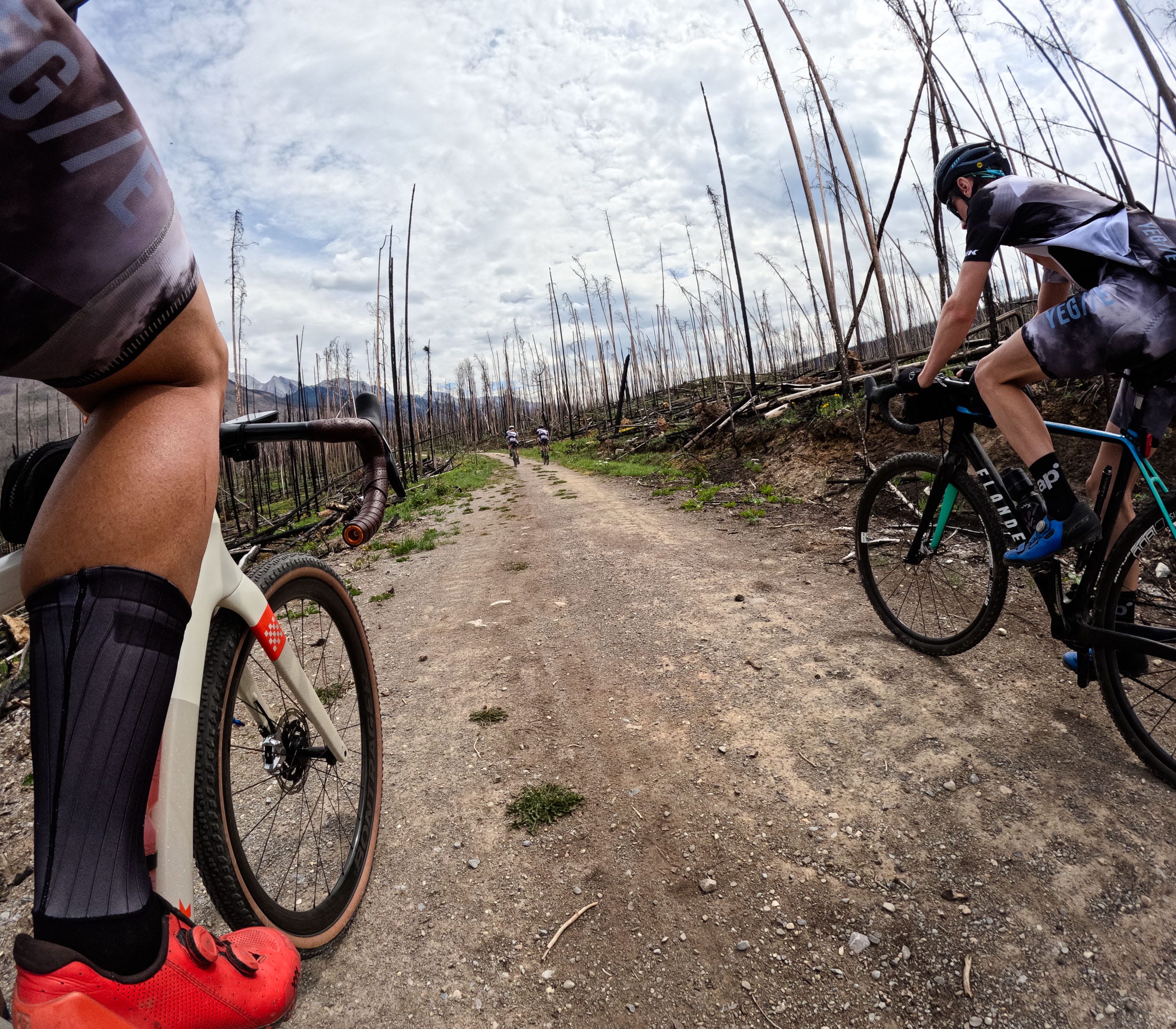
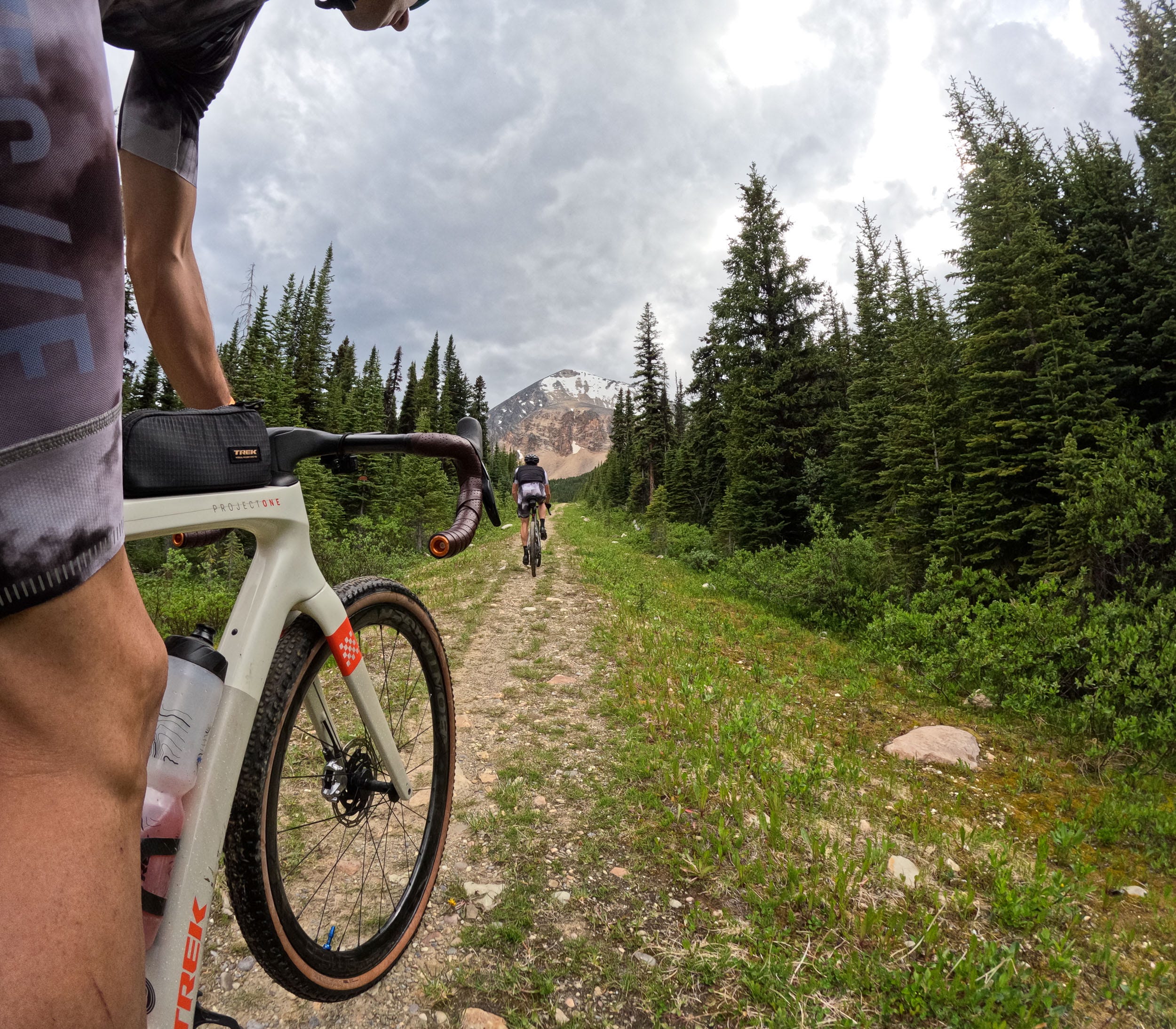
After the quick descent, we made our way toward the big Marmot Basin climb. I had seen what looked like a gravel road branching off from the main paved road a couple of years ago but wasn’t sure what it would be like, as the satellite imagery of it wasn’t stellar. In 2024, another rider, Declan Unsworth from Jasper, had ridden up, which after talking to him, gave me hope for it being passable for the Vision Quest. The other variable was whether the road would be passable this year, as the wildfires had burned almost all the way up the slope to the ski resort. Thankfully, Loni Klettl, a fellow adventurer who has spent her whole life in Jasper, was willing to do some recon for us. While the road was passable, she said that it would be quite tough on a gravel bike as the road was largely now covered in large rocks and dips to prevent vehicles from using it.
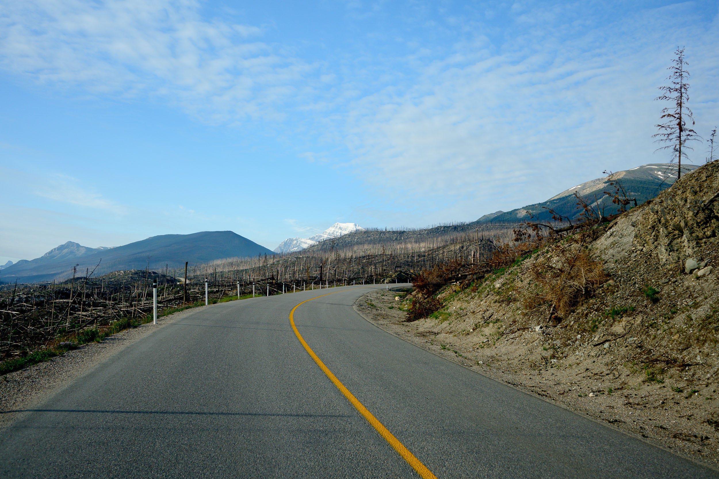
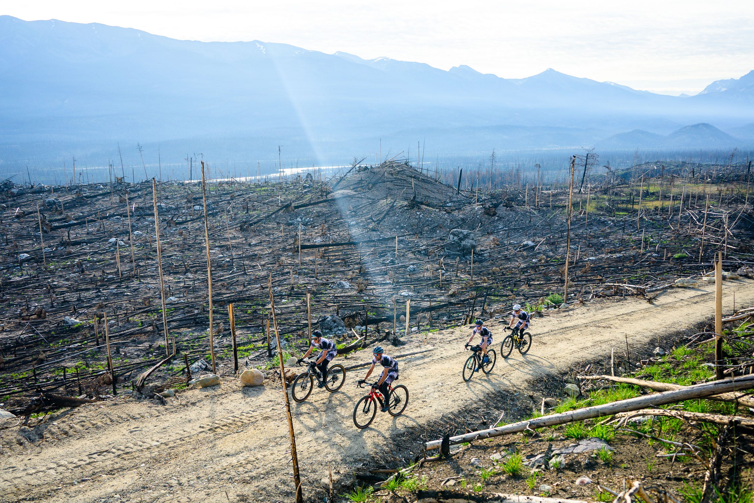
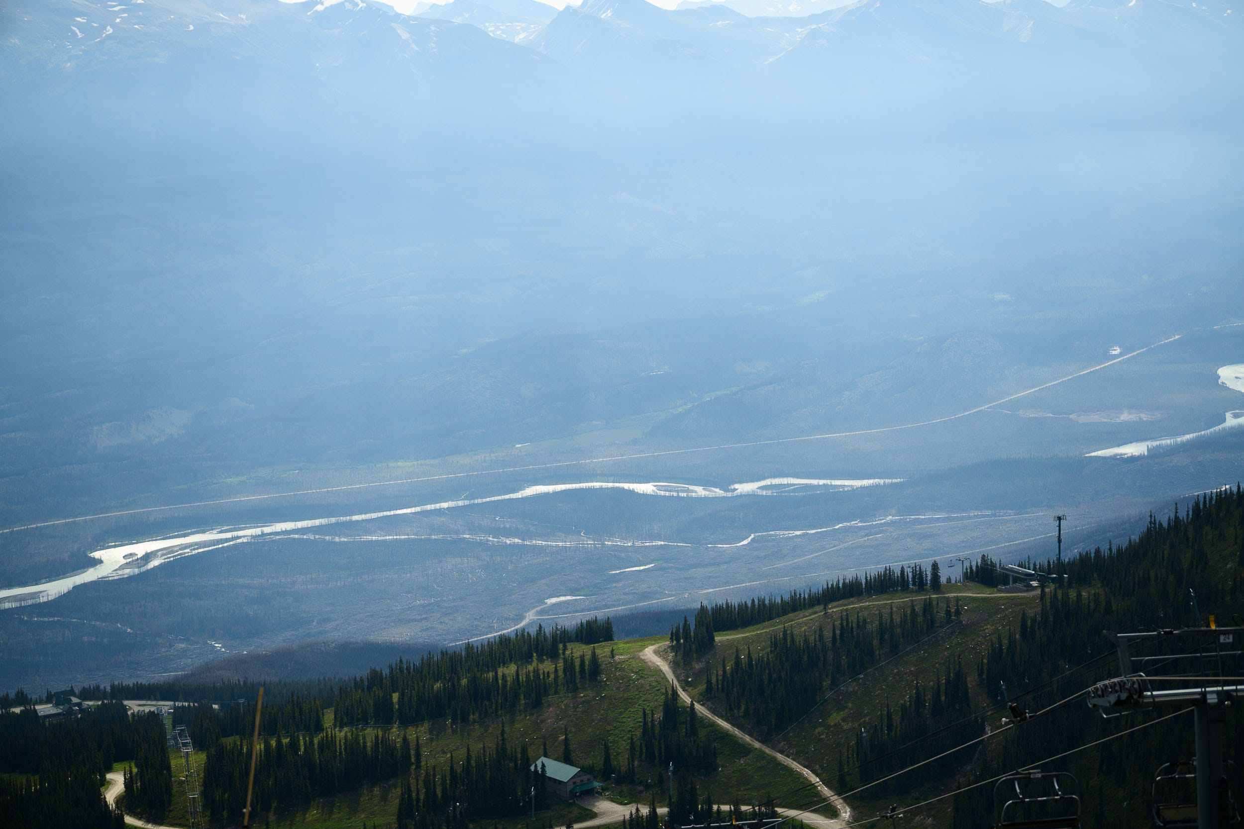
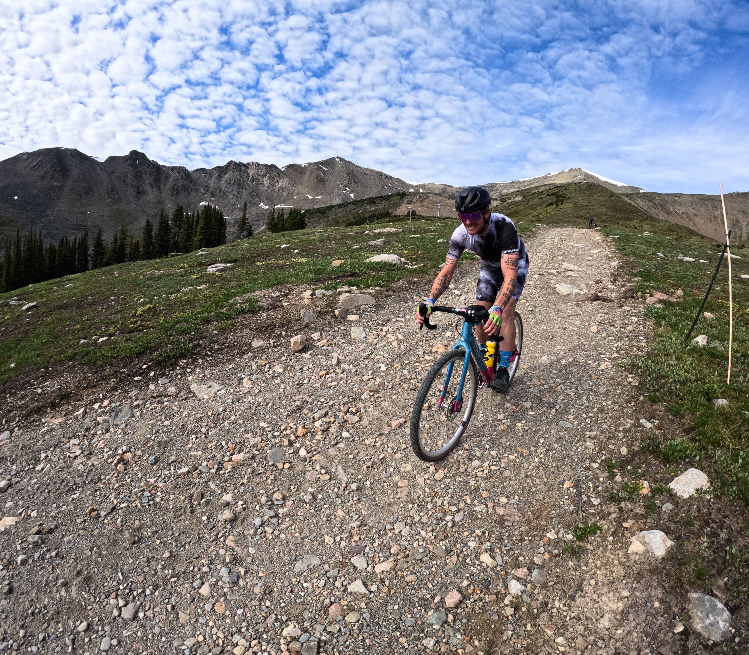
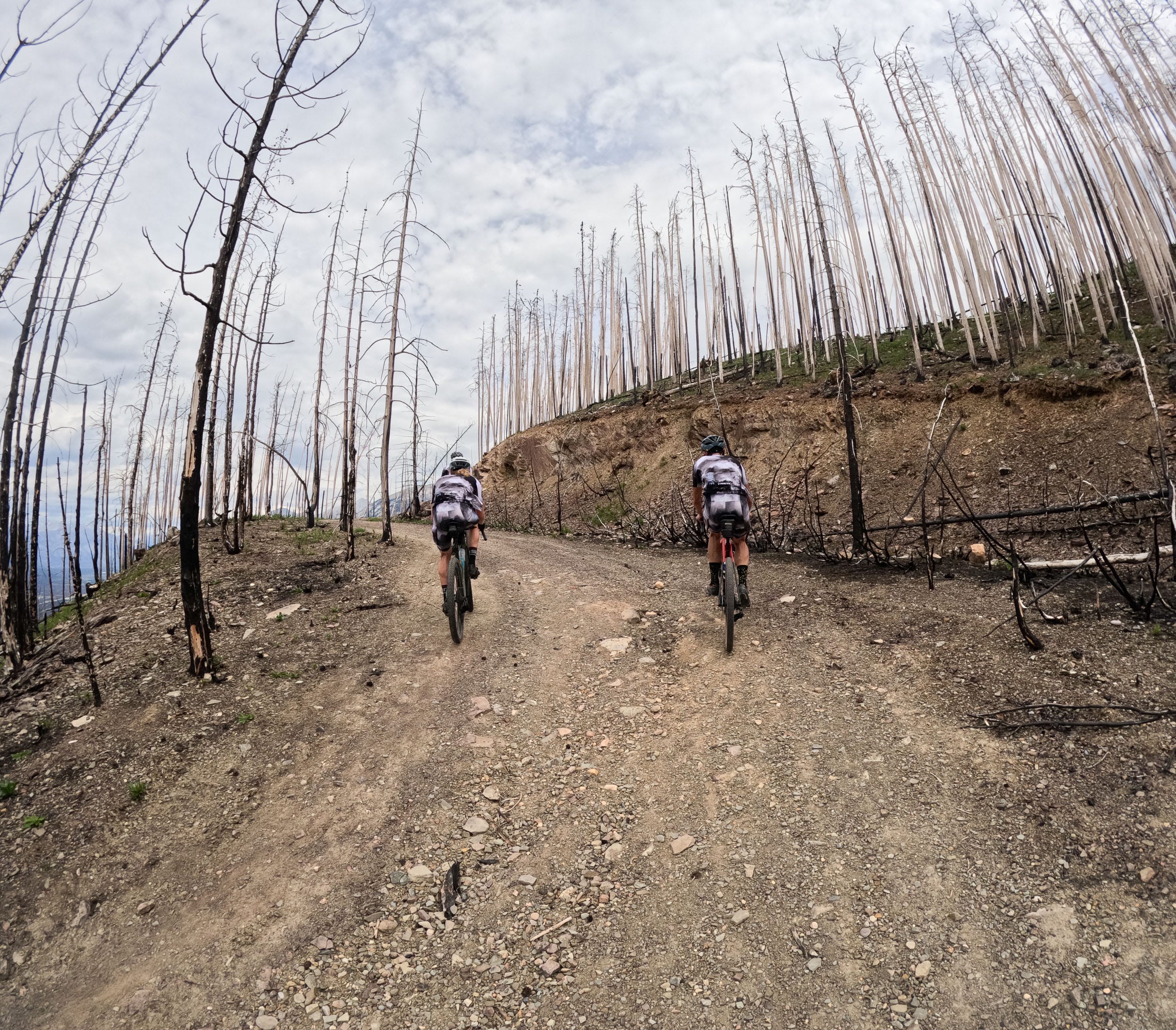
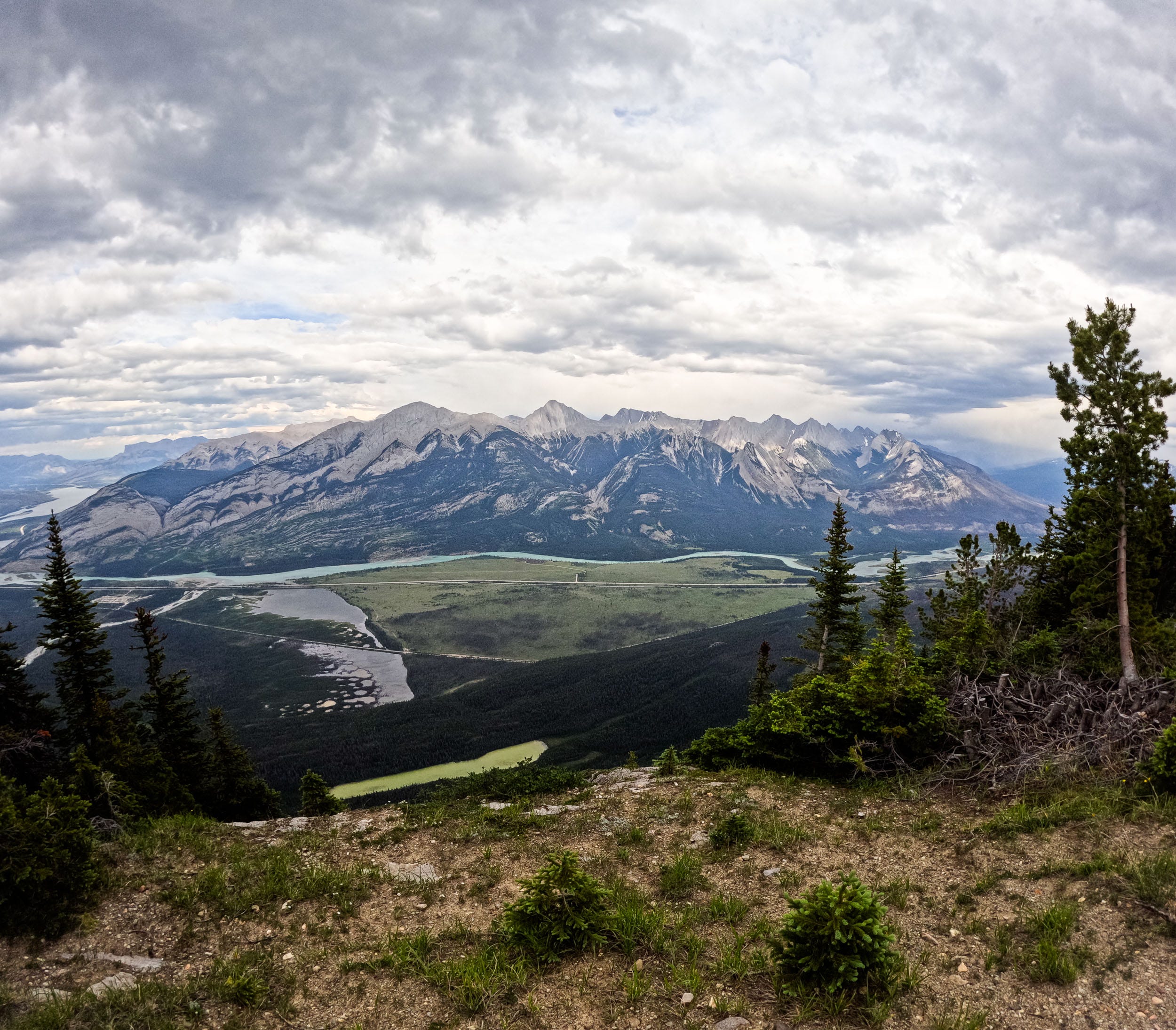
This was by far my favourite climb of the day, both because it was the largest at 1250m of continuous climbing from the valley floor, making it one of the largest climbs in Canada, and also because of the fire-affected terrain it took us through. Riding through an area that was so recently burnt is quite a surreal experience. Not only are the views unlike anything you’ve ever seen, as the trees are all gone, but you now get to experience the forest being reborn again. The vibrant pockets of green among the deadfall were a sight to see. The gravel “road” up to the ski resort actually used to be the main access for the ski hill many decades ago. I can’t imagine what that road would have been like in the winter in the 1960s and 1970s. The switchbacks are extremely tight, and the consequences of coming off the narrow road would be severe.
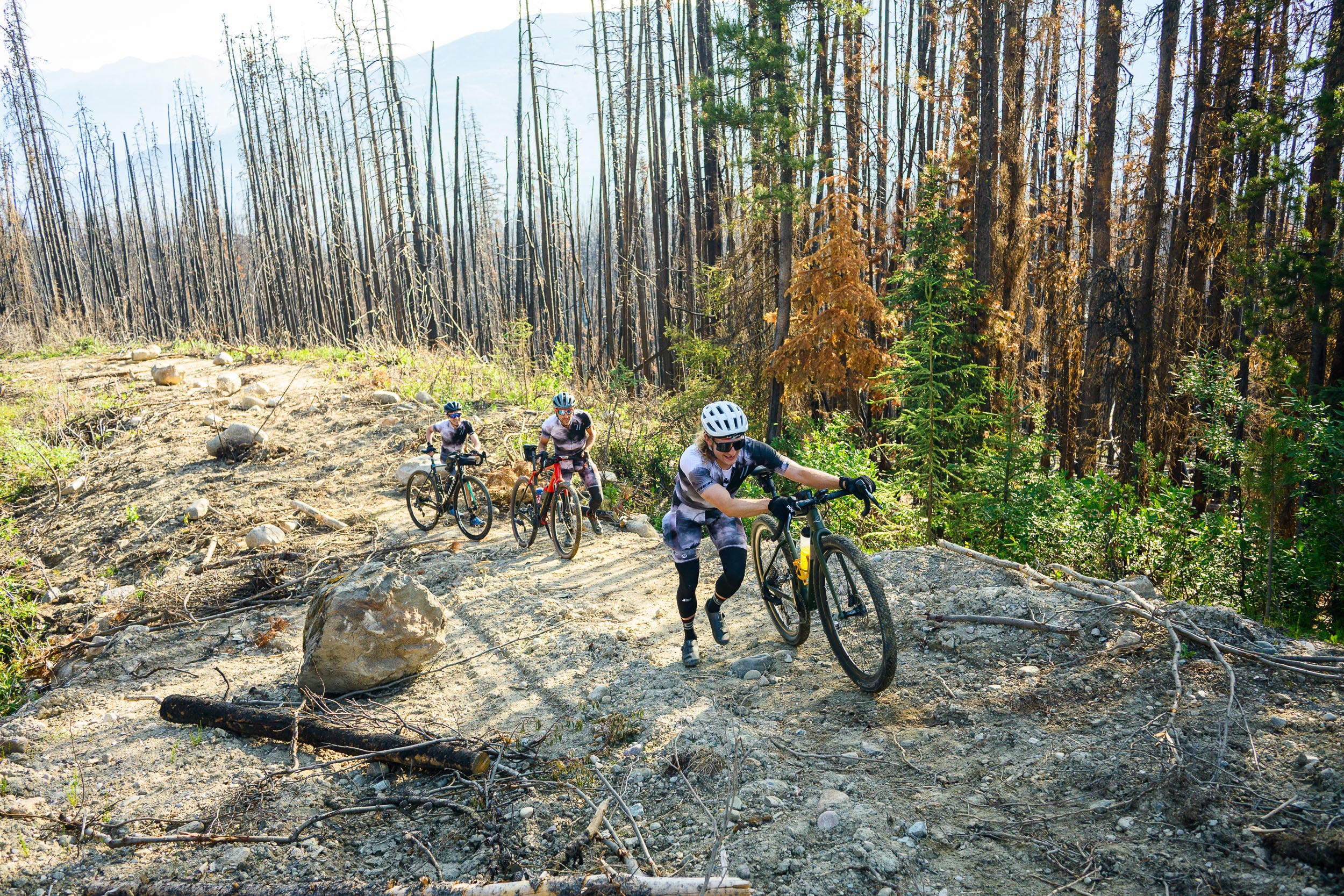
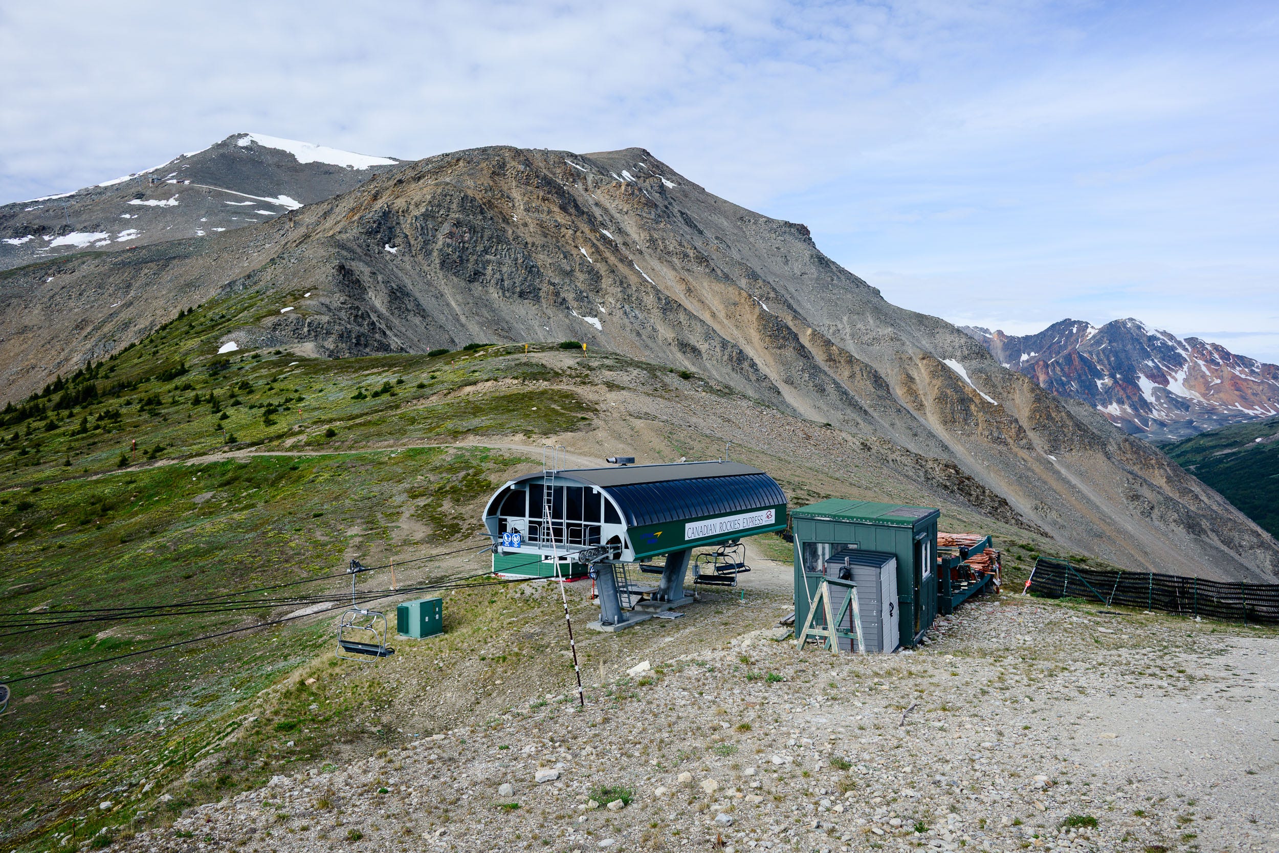
After the old access road was finished, we were treated to the real meat of the climb. We would be riding up the snowcat access the entire way up the ski hill to the top of the Paradise chair. It’s funny how when you’re skiing, the cat track is the easiest way down any hill and feels very mellow, yet when you’re on a bike, it couldn’t feel any less mellow. With this “road” being used by quads in the summer and snowcats in the winter, there is virtually no maintenance or attention to grade being paid. A mountain bike would definitely be the more appropriate choice for this terrain, as the “gravel” consisted of large fist-sized rocks loosely resting on a ski slope. At the very top, the gradient was sustained at 25 to 27 percent for much longer than I ever would have wanted it to be. My mountain bike skills and stubbornness paid off here, as I managed to stay on the bike for the entire climb. This was likely a poor choice in terms of energy expenditure, despite it being very satisfying. At the top, we snacked and briefly let our bodies recover before beginning the descent, which was going to be almost as tough as the ascent.


09:32:44 26.1km 1540m gained
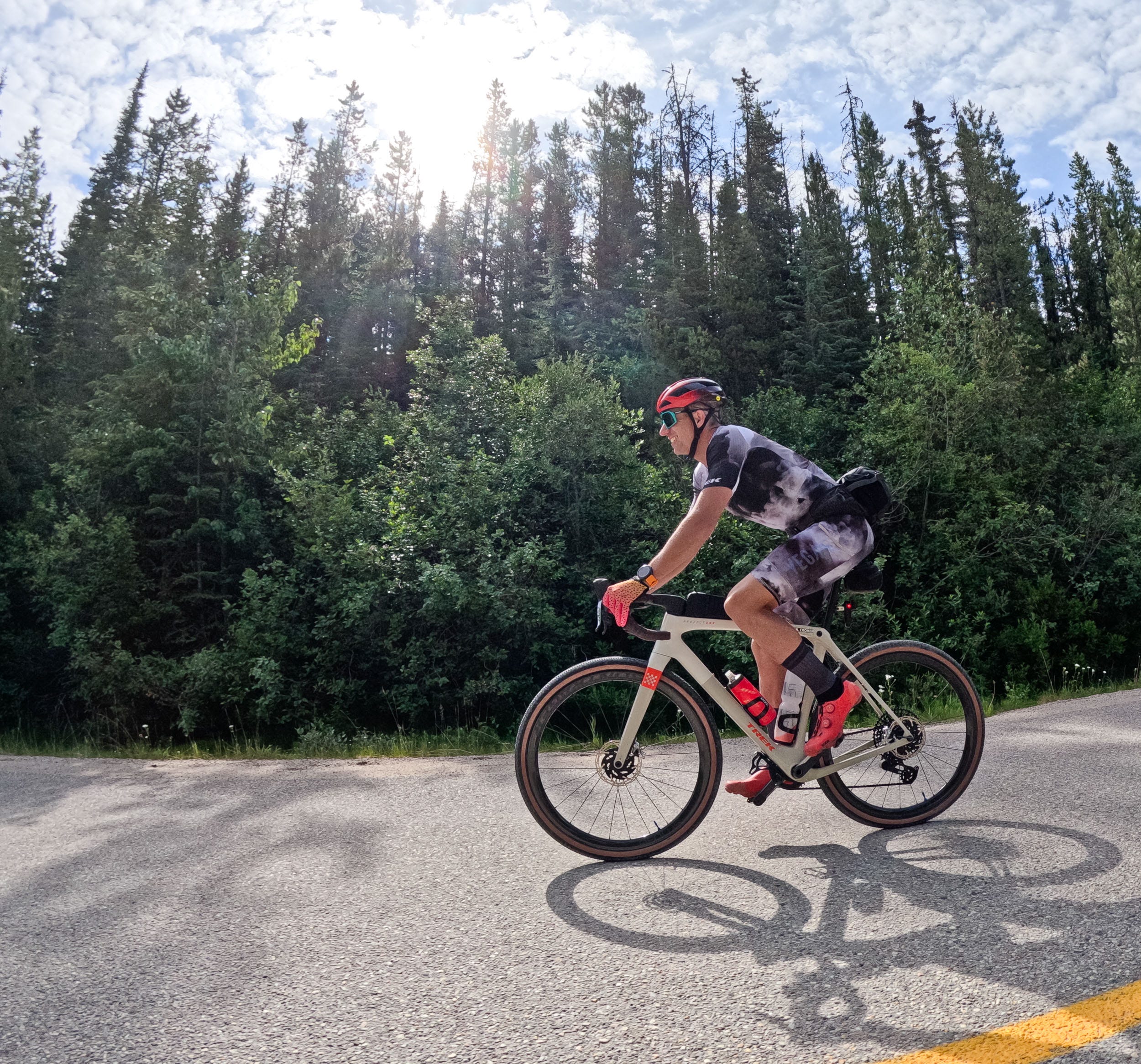
This is where a mountain bike would prove to be the better choice, or at minimum a gravel bike with a suspension fork. Between the steep grades and the very chunky terrain, you needed to stay sharp to ensure that you kept the rubber side down. Some of the guys have minimal mountain bike experience, so this descent was quite unnerving for them as their lives flashed before their eyes multiple times. After coming off the ski resort, we were treated to the paved road for the rest of the descent, a very welcome reprieve as our hands and forearms were in shambles by this point.


10:21 41.7km 1557m gained
Earlier, I mentioned that we’d be riding the paved road up to Edith Cavell. Unfortunately, this road was closed due to fire damage and undercutting during the fires. In the interest of keeping the route as close to the plan as possible, we opted to climb back up the paved portion of Marmot Basin to the ski resort but forgo the brutal climb to the top of the actual mountain. Compared to what we had just done, this felt like a recovery climb, as we weren’t fighting with the terrain and bikes to stay upright. As soon as we got to the top, we flipped around and enjoyed another paved descent, our last one of the day.
11:07 52.2km 2114m gained
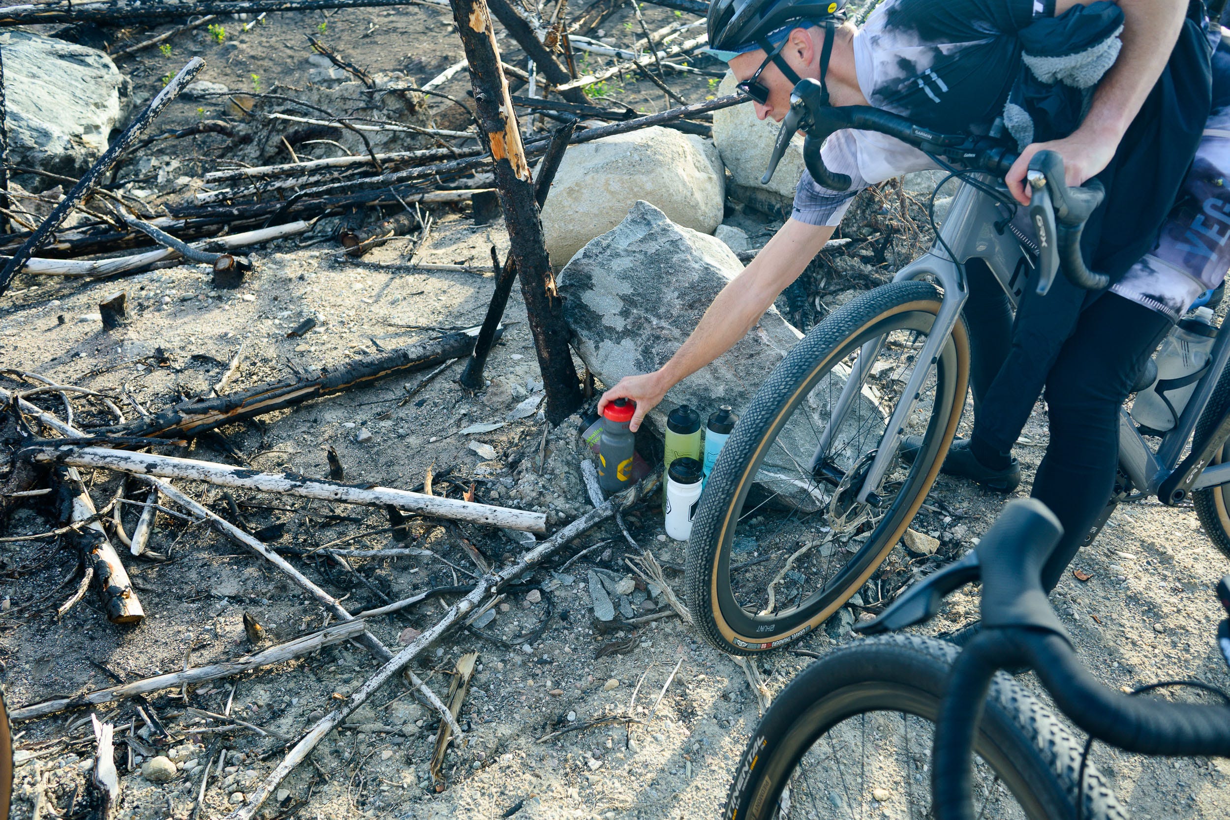
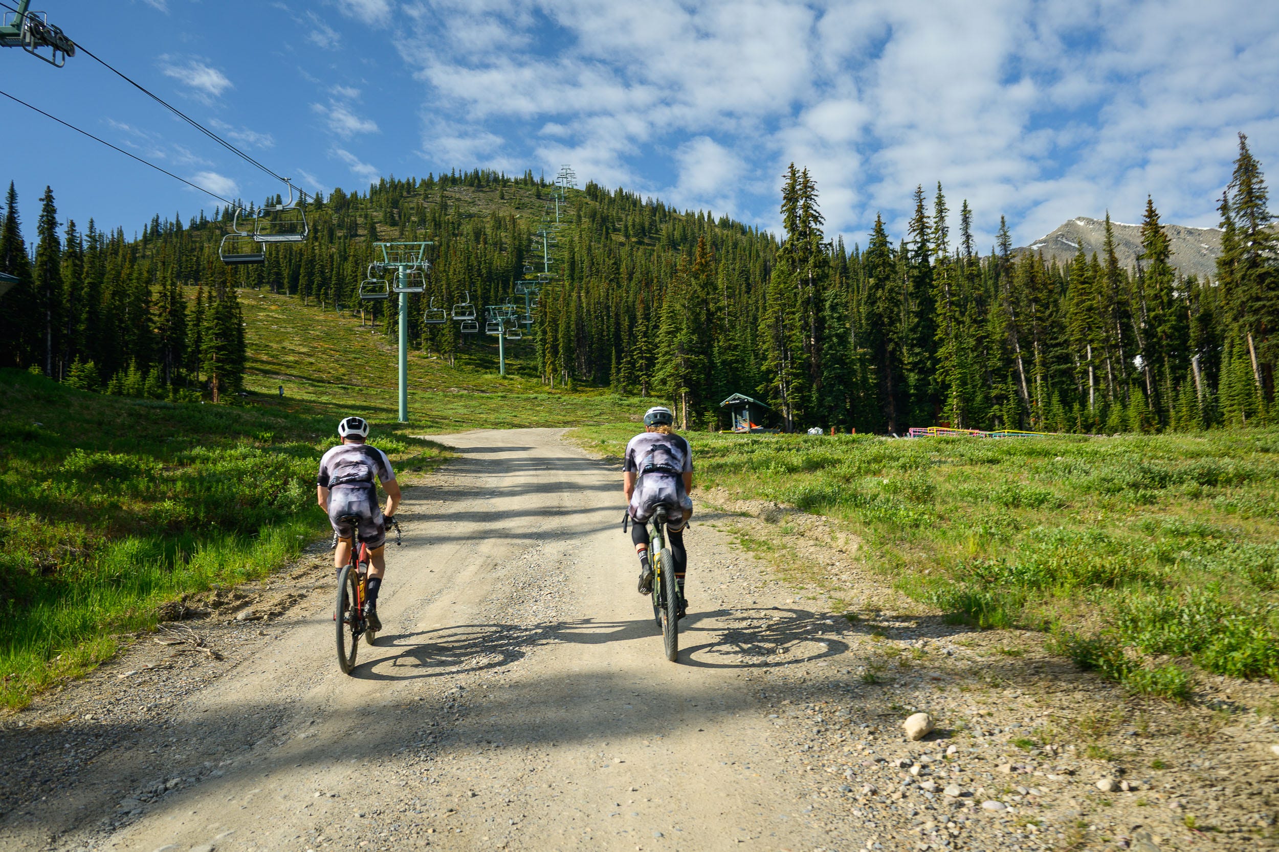
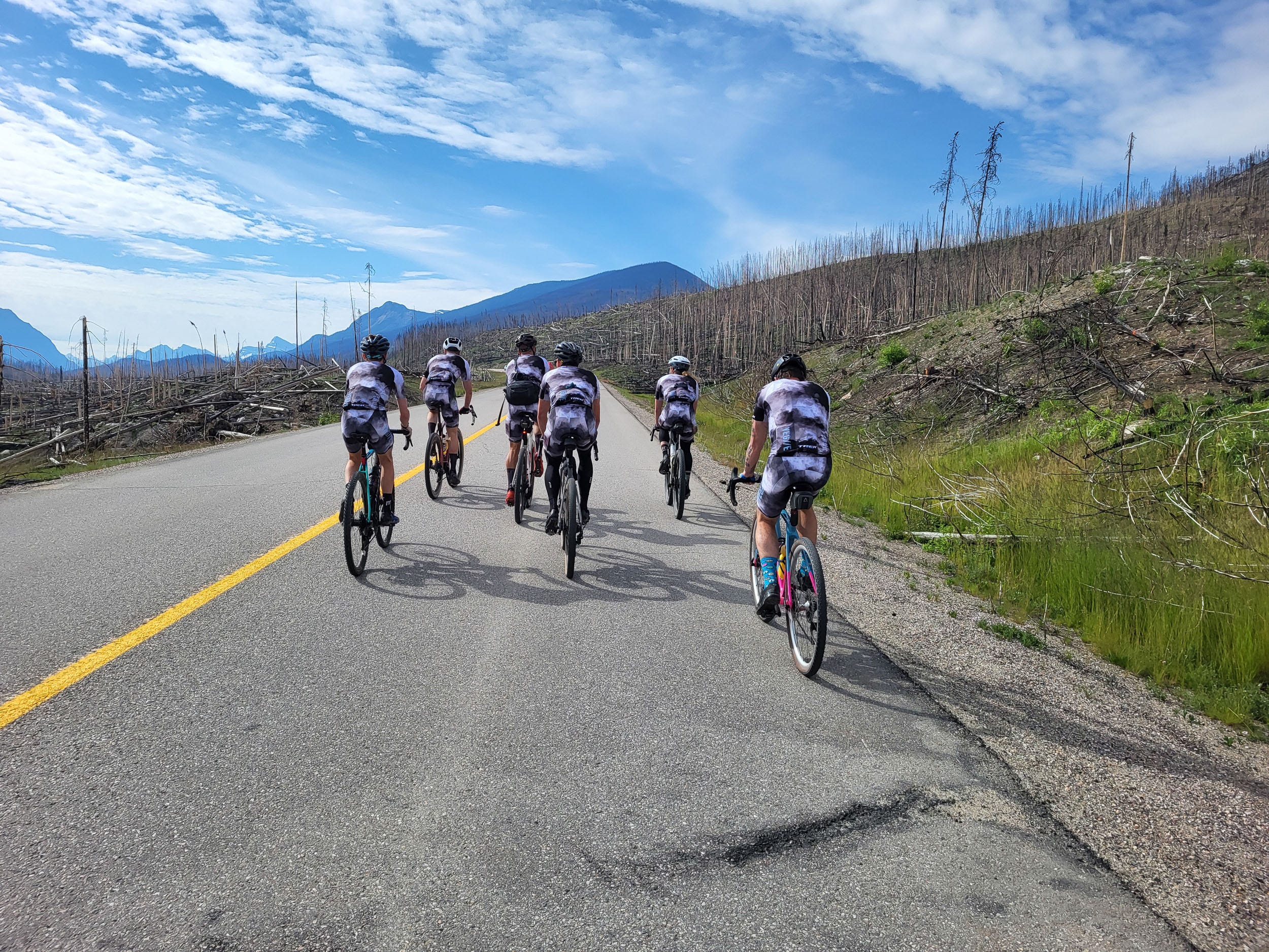
On our way to the next climb, Signal Mountain, we stopped back in at camp to grab some food and refill our bottles. Unlike last year when we had Nina meet us for a refuel, this was a much better solution. Last year, due to trail conditions, we were three hours behind when we had told Nina to meet us, so she sat there for three hours as we had no cell service. After slamming more liquid carbs and half of a homemade pizza, we were ready to roll again. Even though the break was kept short, our legs and guts all felt quite heavy when we started turning over the pedals. Thankfully, the transit to Signal Mountain was mellow and very scenic, just what you want as you warm your legs up again.
12:50 84.6km 2269m gained
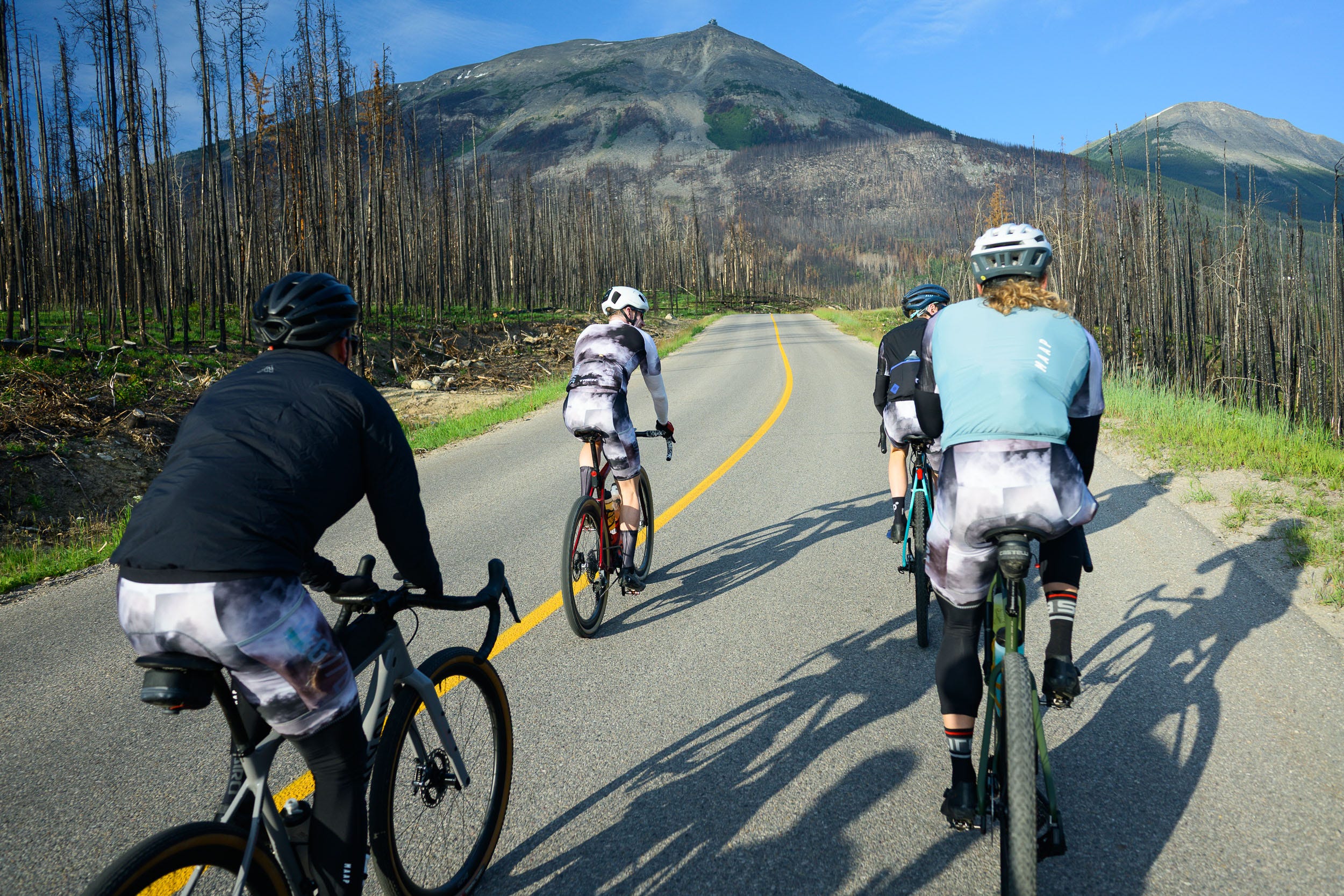
As we made our way toward Signal, we had all forgotten that there is a steep paved climb on the approach. None of our legs were feeling great here, and we were still digesting our lunch, so this felt like more of a kick in the pants than it probably should have. We were all looking forward to the Signal climb, not because we love 10 km of 10 percent on gravel, but because the views were going to be unlike anything they’ve ever been on that road before. The fires burnt everything right to the top of the mountain which meant we’d have an amazing view of the valley for the entire duration of the climb, a stark contrast to the complete lack of view we had last year. The trail up to the top was in better condition than the previous year as well, as it was well-traveled by the fire clean-up crews. One of the big perks of the fire is that there won’t be any trees across the trail for many years to come.
14:17 95.8km 3353m gained
While we tried to stay together on this climb, the differences in fatigue were starting to show, and the gaps opened up between us. Not only did the gaps open up, but the conversations became more limited, as everyone was feeling a bit beat up by now despite having a couple more climbs to tackle. As we crested over the top, we were greeted with the classic winds that rip up the face of Signal. With no shortage of fatigue in our bodies, we didn’t spend much time taking in the views, as we knew that the final climbs were going to be punishing. Descending Signal this time was quite fun, as it was smoother than in previous years. Will and I have the most mountain biking experience, so we felt quite a bit more comfortable letting off the brakes and letting the bikes eat on the way down. In retrospect, we were probably going way faster than we should have been, considering we were on unsuspended gravel bikes. At one point, we could feel the heat from our front brakes radiating up to our handlebars, followed quickly by brake fade. After a brief stop to let them cool down, we continued down to the parking lot where we’d wait for the others before heading to the next climbs.
The ride to the double-headed beast that is the Palisades and Pyramid climbs is short, as they are just across the valley from Signal. The paved road up to Pyramid Lake is a mellow one, which is nice as it eases the legs into what is about to come. Steve and I were the only two on the ride this year who had done the Palisades climb last year, so we knew exactly what we were in for. The other guys were all smiles in their ignorance for the brutal effort that was waiting for them.
15:16 132.1km 4438m gained
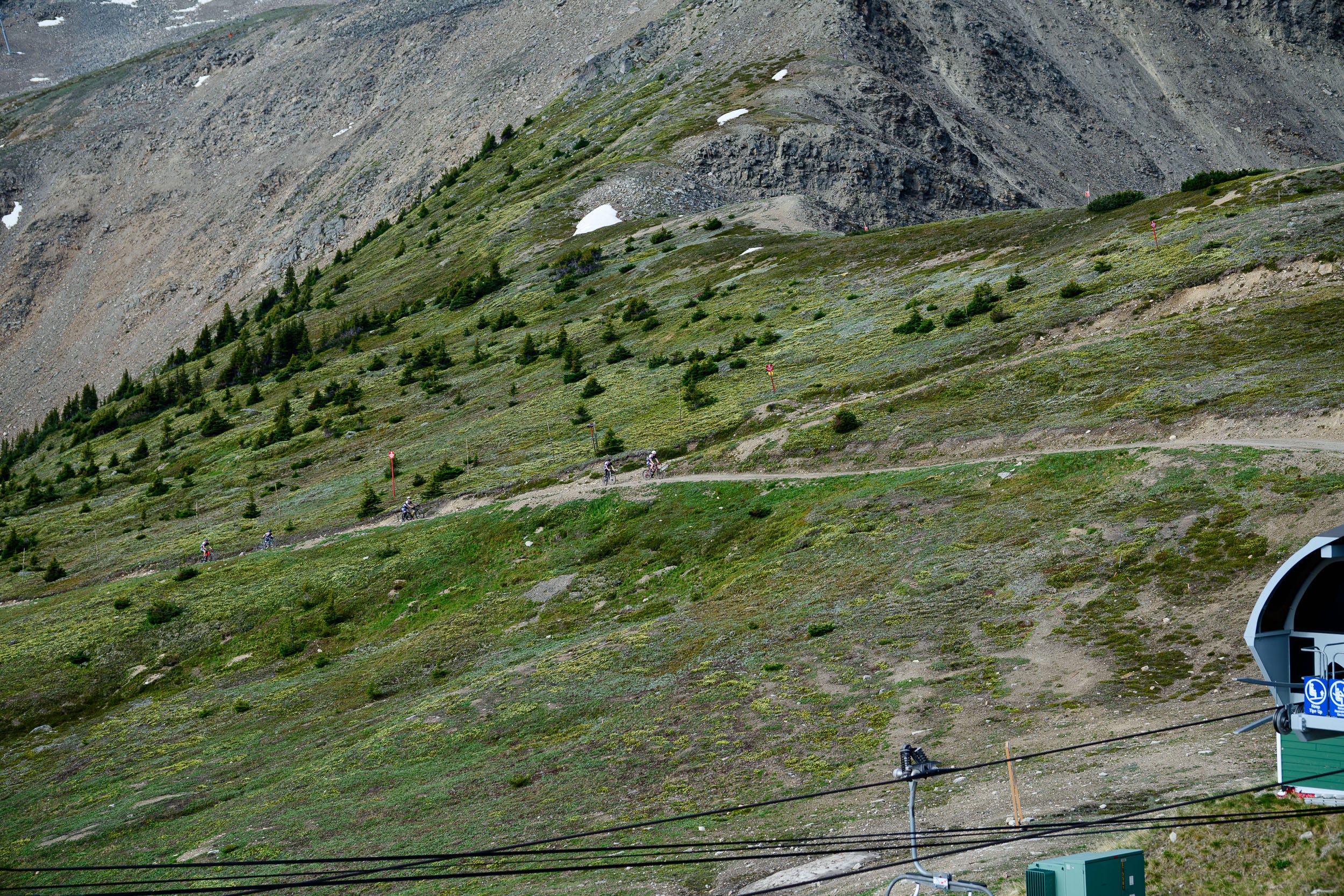
The climb starts off on a nice, maintained gravel access road with moderate grades, giving you a false sense of optimism for how the climb will go. About halfway up the climb, there is a fork in the road, Palisades to the right and Pyramid to the left. As soon as you turn right, the climb becomes an entirely different beast. Not only is the grade significantly more severe, but the gravel deteriorates to large river rocks that are somehow not sliding down the slope. Line selection is a battle, as where the bike goes and where you’d like it to go are often very different. This climb is very much about spending time in your granny gear and hoping that your back wheel doesn’t break traction on a loose rock. As you get higher up, the gradient becomes steep and the “road” becomes simply atrocious. The one upside of the climb this year is that, for the first time in over 20 years, the brush had been cut back. Last year, the path through the brush was only about two feet wide, which was quite spooky, as there is no shortage of bears on this mountain.
As expected, we were all riding the climb on our own, as line choices and fatigue quickly opened up gaps that simply weren’t recoverable. Once at the summit plateau, you are again treated to an amazing view of Jasper. The mosquitoes were also treated to a feast of a group of sweaty, tired cyclists. I’m not sure about you, but my patience for mosquitoes is minimal on a good day, never mind when I’m exhausted and not really seeing straight anymore. Due to the bugs, the summit time was minimal again. We took great care descending, as the rocks are sharp and loose which meant one lapse in judgement or control could be catastrophic. The only help up here would be from a helicopter. As tired as our legs were, our upper bodies were now truly beat up from the descending. Forearms were on fire and blisters were forming on our palms. Despite being able to handle the terrain, the ergonomics of road bars and hoods don’t lend themselves to being comfortable over thousands of meters of rough gravel descents.
17:35 135.5km 4448 gained
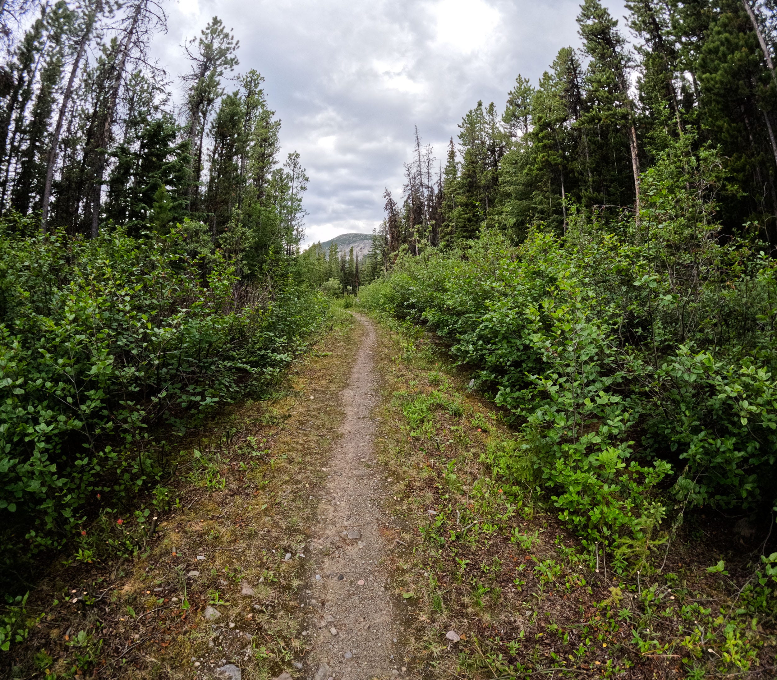
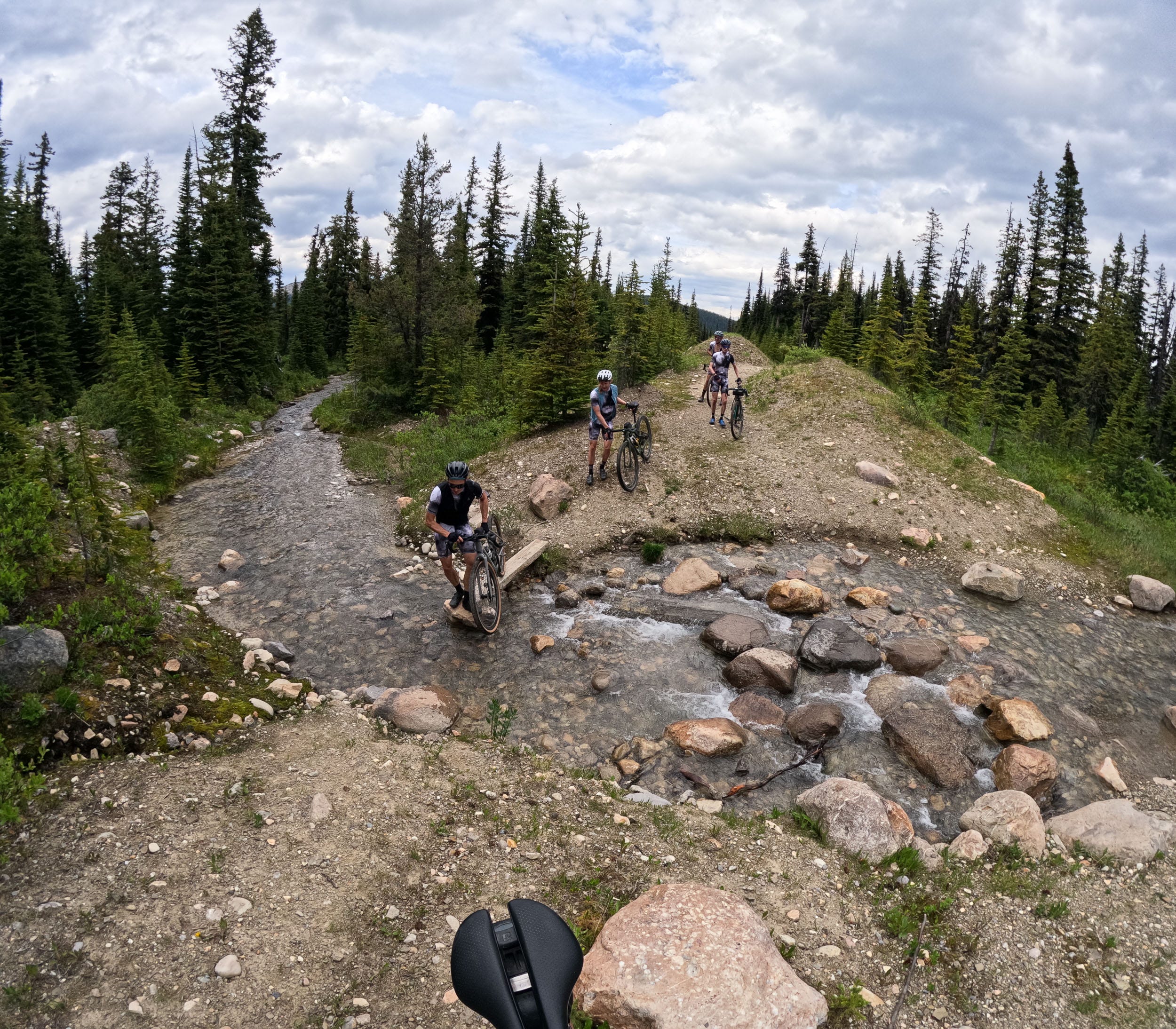
Once we descended to the fork in the road, we were on our last climb of the day, the old access road to Pyramid Mountain. Thankfully for us, this was a much more civil climb and definitely the best one to finish the day with. The gradient was nowhere near as steep, and the trail was in great shape, as this is a frequently ridden path due to it being part of the approach for the scramble that goes up Pyramid Mountain. What surprised us on this trail was how wet the whole climb was. We were riding in a heatwave, and up until this point, we hadn’t seen a drop of water on our route. There were quite a few sections where it was very muddy, to the point that traction was at a premium. While the mud wasn’t fun to ride in, the cool water kicking up on our legs was quite nice, as it was still over 25 degrees.
18:08:43 139.4km 4801m gained
Similar to the top of the Palisades, we were treated to more bugs at the end of the road. We wasted no time turning around and starting the discussions of what we were going to roast on the fire and the beers we’d be treating ourselves to when we got back to camp. After the fork in the road, the descent was very smooth and fast. Again, we were likely going way faster than we should have been given our current physical and mental states. Thankfully, we all made it down without any drama.
19:14 161.8km 4882m gained
As we were rolling through the town of Jasper, we had the unfortunate realization that we had not broken 5000 m of climbing, likely due to us not being able to ride the Edith Cavell road. After some heavy persuasion, I convinced the guys that we would ride up the Tram climb again until we broke 5000 m. Thankfully, we only had to go about a third of the way to crest 5000 m.
Finished at 19:27 166km 5033m gained
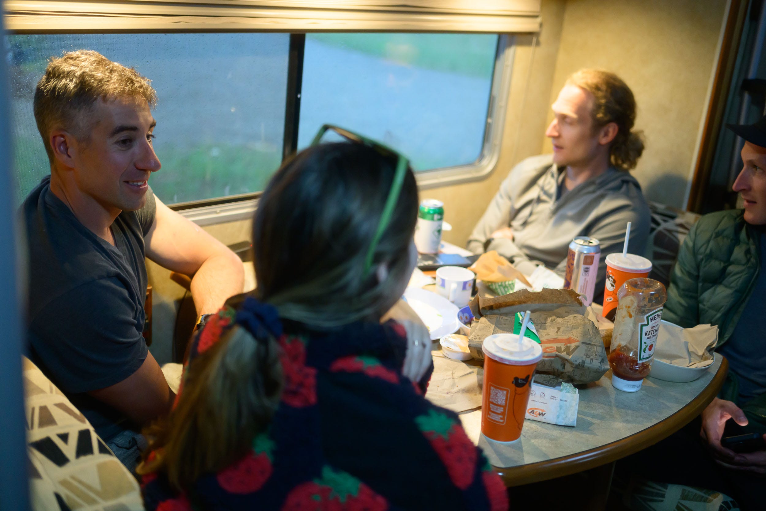
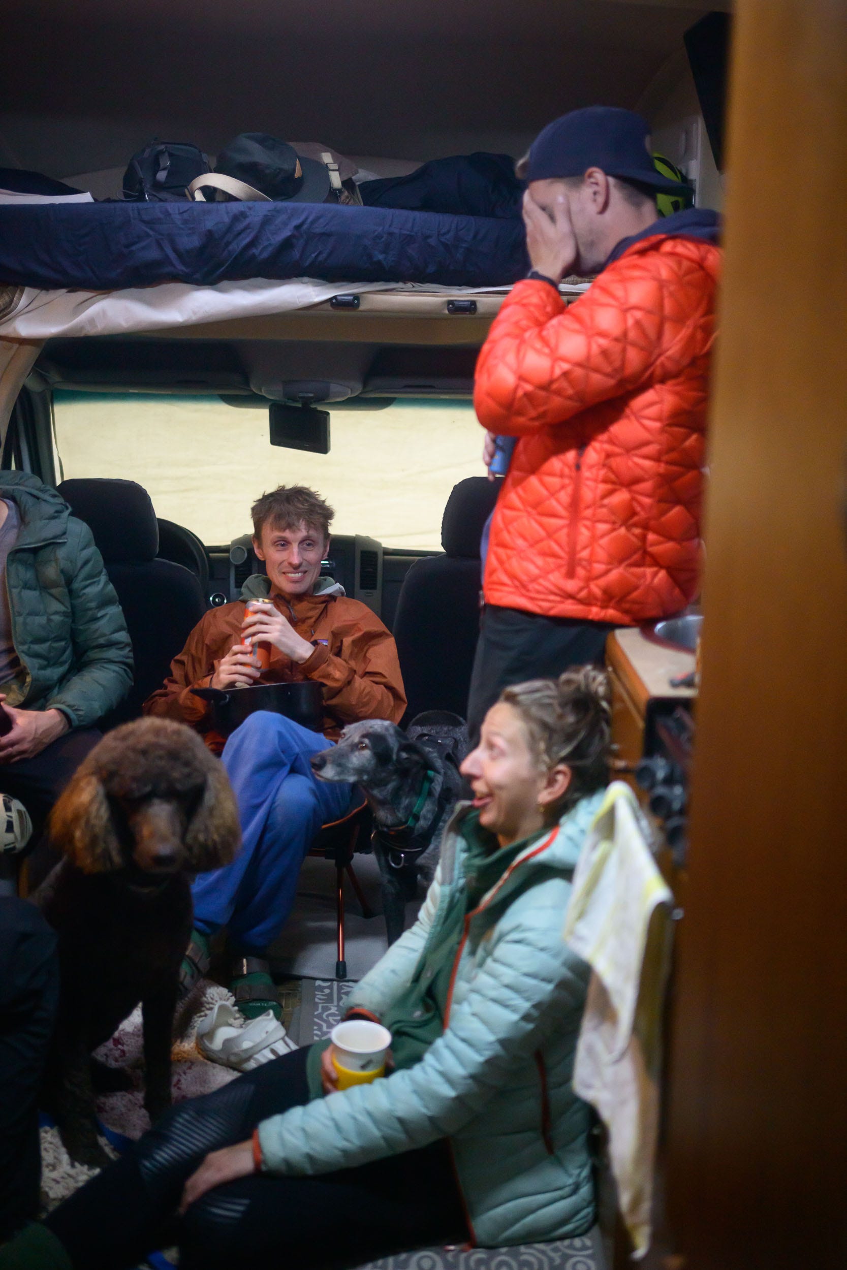
When we returned to camp, we had high hopes of a big social gathering with food and drink around the fire. Mother Nature had different plans for us. Within 30 minutes of being back at camp, a massive storm appeared out of nowhere, bringing both rain and 100 km/h winds. With the campground now effectively being a parking lot with no trees, there was no shelter to be had from the storm. While we were cozy inside our motorhome, other campers were not so lucky at all. We watched tents and camp chairs flying through the air, likely to never be seen again. A few people from our group decided to load up their kids and gear into their cars and head back to Edmonton. Can you imagine you’ve just done the longest ride of your life and now you have to load up your young kids into the van, tear down camp and then drive four hours home? I can’t. The folks who weren’t heading back to town took shelter in our motorhome in the hopes that the storm would pass. We had three dogs, two kids, and eight adults piled into the 24-foot motorhome, a far cry from the group sitting around a fire enjoying snacks and drinks into the evening. Three of them decided to grab a hotel in Hinton, which provided us with our entertainment for the evening. I’m not sure if you’ve ever watched two guys try to tear down a camp in a violent storm while being utterly exhausted before. The thought of helping them was brief, as sitting in the camper while watching them try to take tents down in the pouring rain and wind was much more entertaining. Sorry boys. We still laugh about them trying to fit lawn chairs into their bags for five minutes instead of simply hucking it all into the back of their cars and dealing with it later.
All in all, the day was what we had hoped for, and likely a bit more, especially on the Marmot Basin climb. When people ask what the secret is for big days like this, I try to drive home how critical nutrition is. Having a base level of fitness only gets you a few hours into a ride of this nature, and after that, you need to properly fuel your body. For this ride, I was taking on 80 g of liquid carbs per hour and then about another 30 every two hours from snacks that I had packed. Lunch was real food in the form of a homemade pizza, as you can only consume so many carbs before you lose your appetite. Having a nutrition plan and sticking to it is critical, as if you go an hour without enough nutrition, your ride is now in grave danger of not being possible, never mind enjoyable.
All in, the ride was 166 km with 5033 m of climbing. The total duration was just over 12 hours, with just under 10 hours of moving time for an average speed of 16.9 km/h. My normalized power was 231 watts, and I burned 6500 calories. A big day on the bike no matter which way you look at it. While the ride was 40 km down on distance from the 2024 Vision Quest, the extra 1000 m of climbing in the condensed distance, with more sustained climbs, made it quite a bit more punishing. To see all of the details you can view the activity on strava here.To keep with tradition, the 2026 ride is going to need to be harder, and I’ve already got some ideas brewing, such as making it a mountain bike ride to open up more terrain within Jasper.
Thanks for taking the time to read this one, it was a ride for the ages. All images and words by Nick Croken (www.redlinephoto.ca) unless otherwise indicated. You can check out the video I made of the ride as well, below. If you enjoyed reading this, please share and subscribe.